The Tom McCall Point trail and Rowena Plateau trail is a superb open-skies hike in the eastern Columbia Gorge, perfect for hitting the trails on a sunny day in early spring!
The weather was more than kind to us for early April, with sunny skies and temperature around 70F—excellent for catching some rays and viewing the wildflowers, with a little bit of elevation gain to get the heart pumping.
Tom McCall Point Trail Report
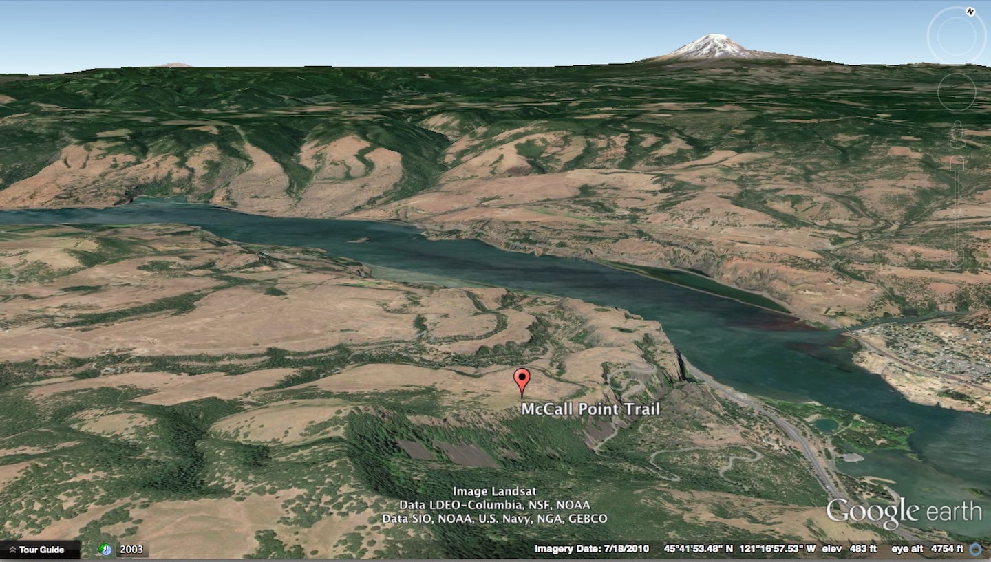
The Tom McCall Point trailhead is located 75 miles (1.5 hours) east of downtown Portland, between Hood River and The Dalles on the Oregon side of the Columbia River Gorge.
The hike is around 3.5 miles round trip, from the parking lot to the point and back, with an optional 2.0 mile easy add-on loop hike around the Rowena Plateau (which also leaves from the parking lot).
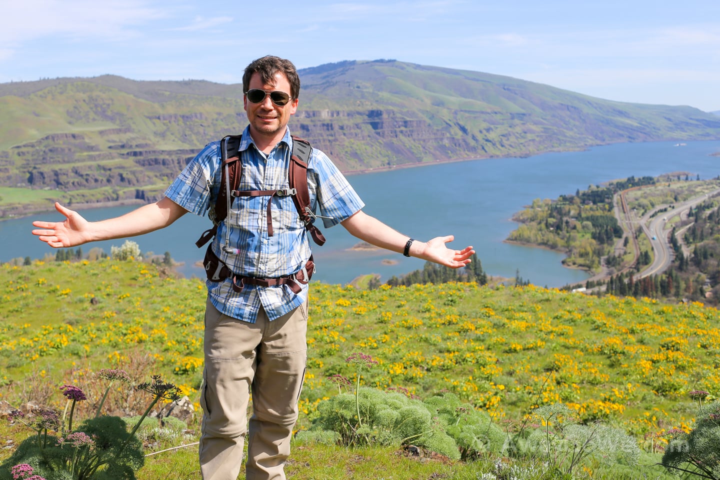
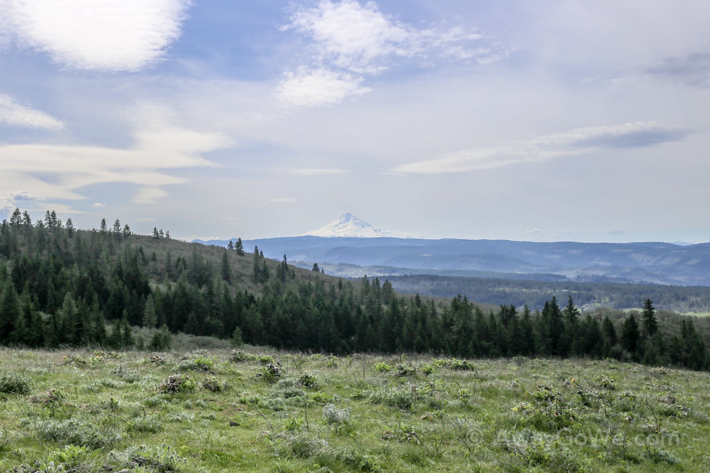
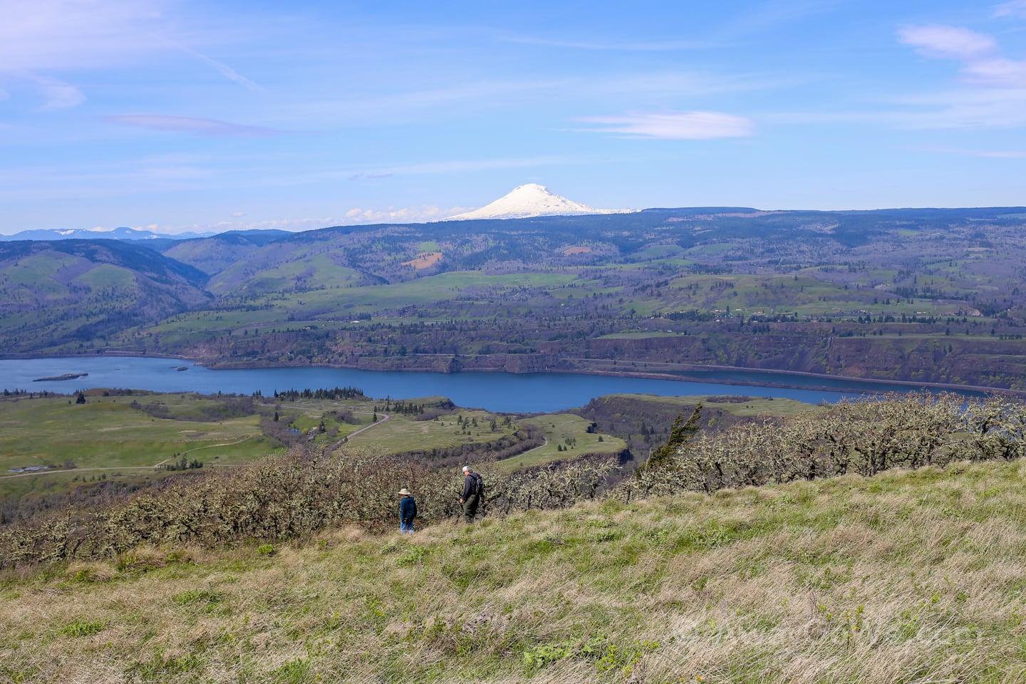
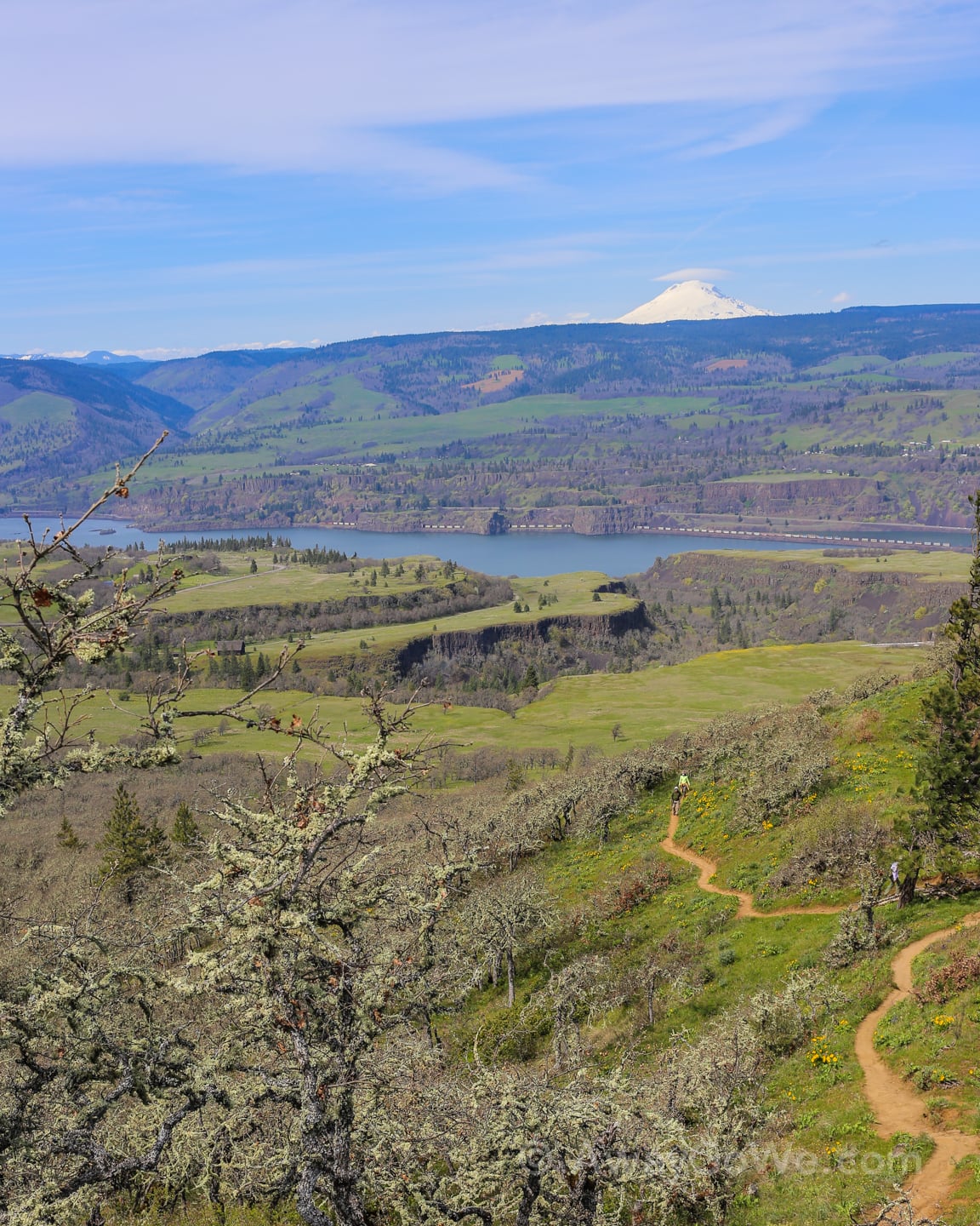
The trail gains about 1,200 feet of elevation from the trailhead to the top of the point. Look out for nice views of Mt. Adams and Mt. Hood on a clear day (each about 35 miles away).
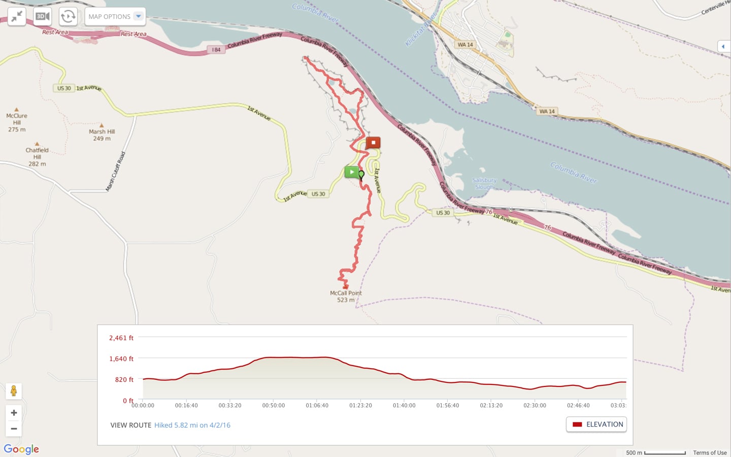
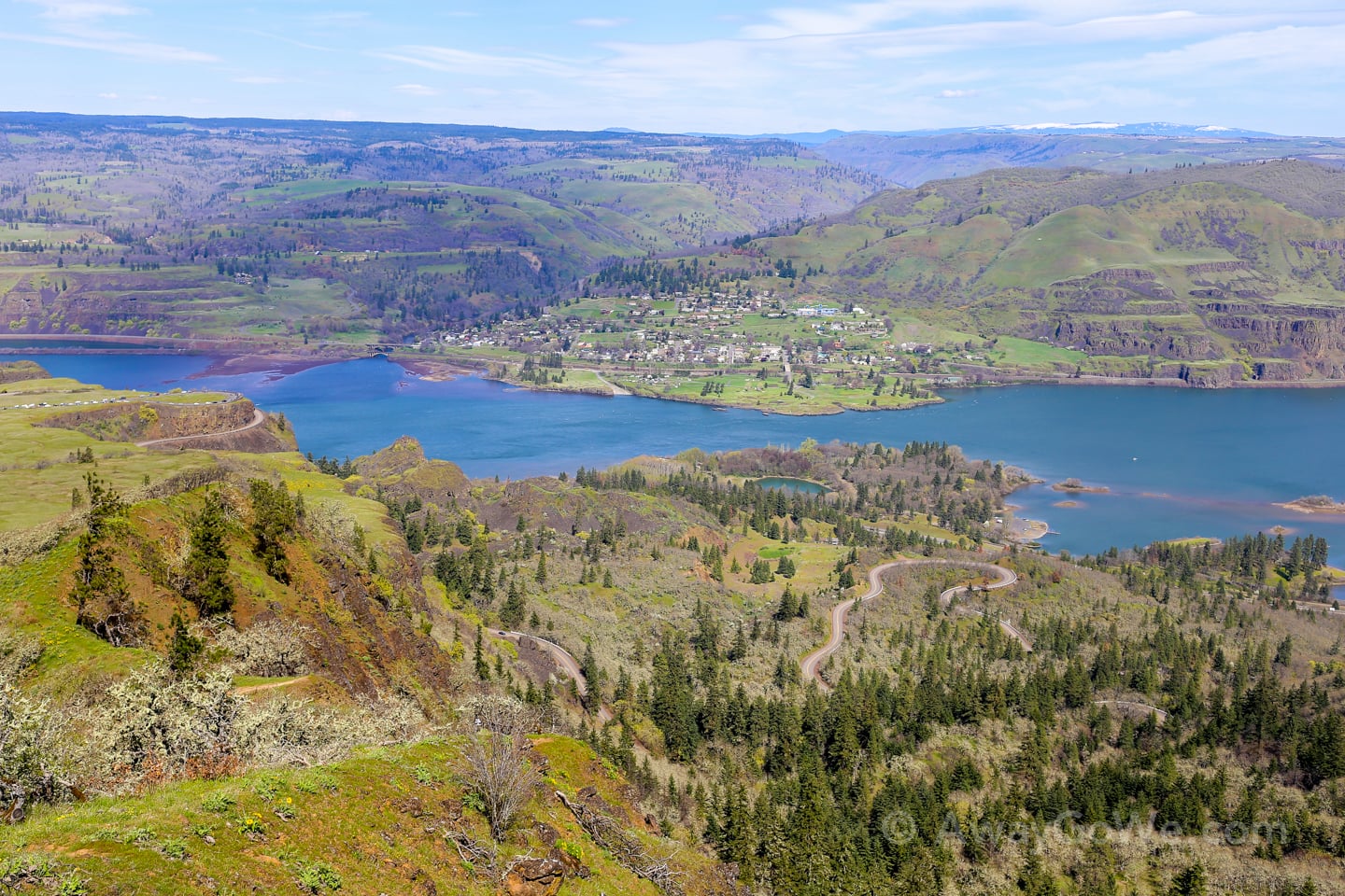
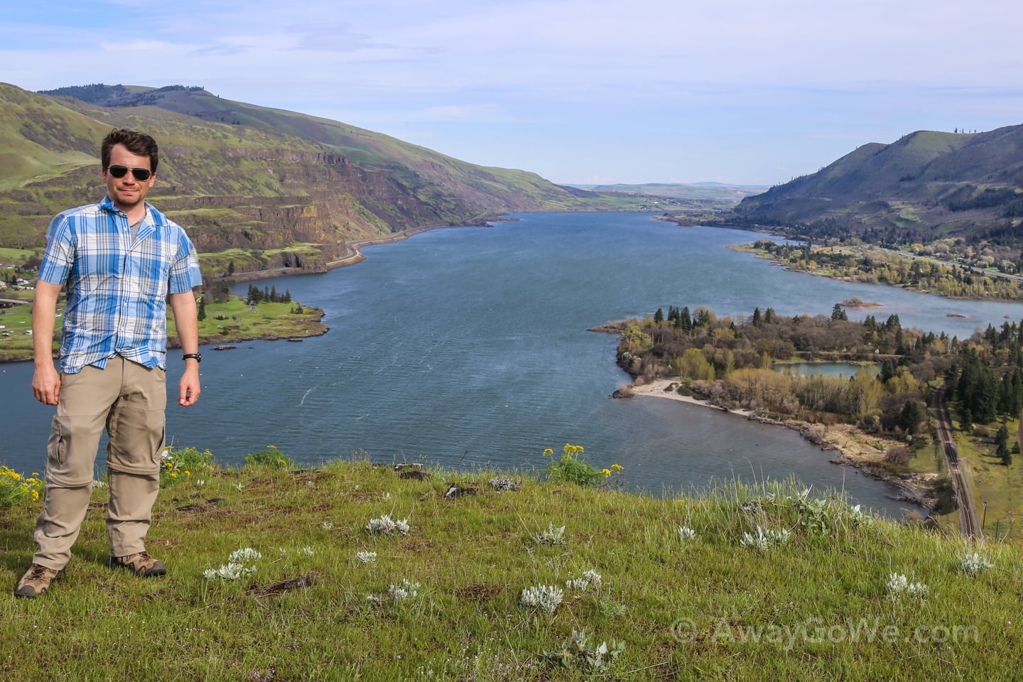
Above: View from the parking lot up to the top of McCall Point.
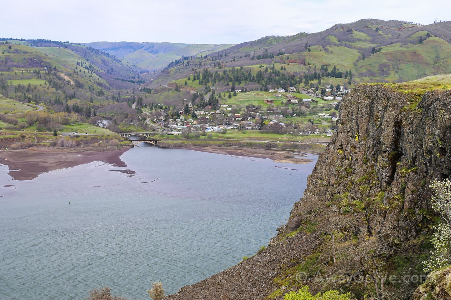
Below: View looking back towards the parking lot and eastward up the Columbia River.
Traffic on the trail was surprisingly light, considering the weather and starting the hike mid-morning on a Saturday.
We picked the McCall Point hike due to its distance from Portland, as we thought that the beautiful Saturday weather might impact trail traffic on the hikes closer to the city. Seems we made a good decision.
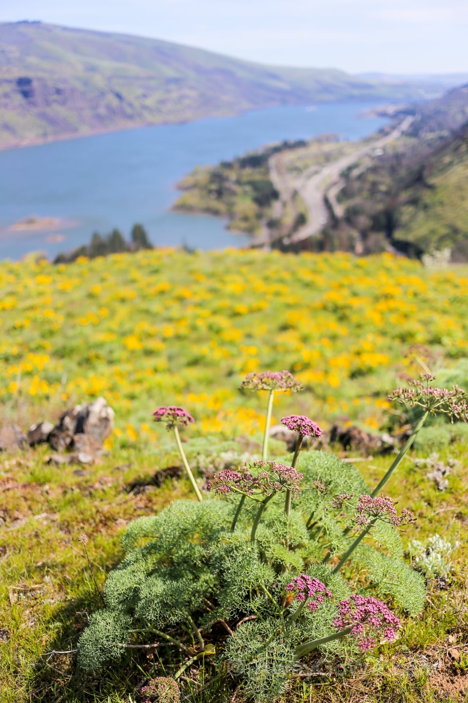
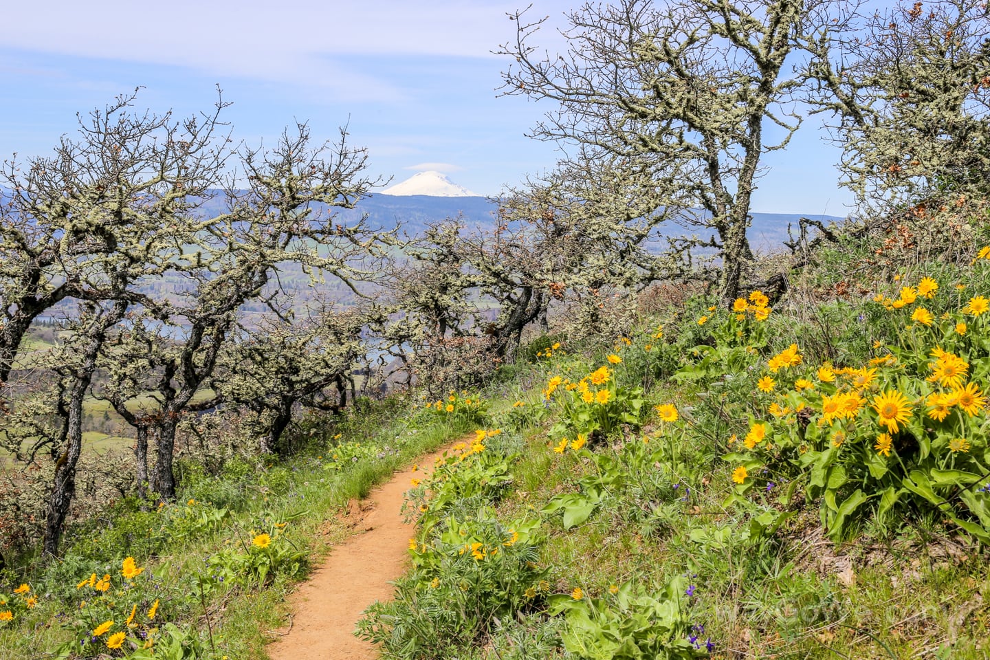
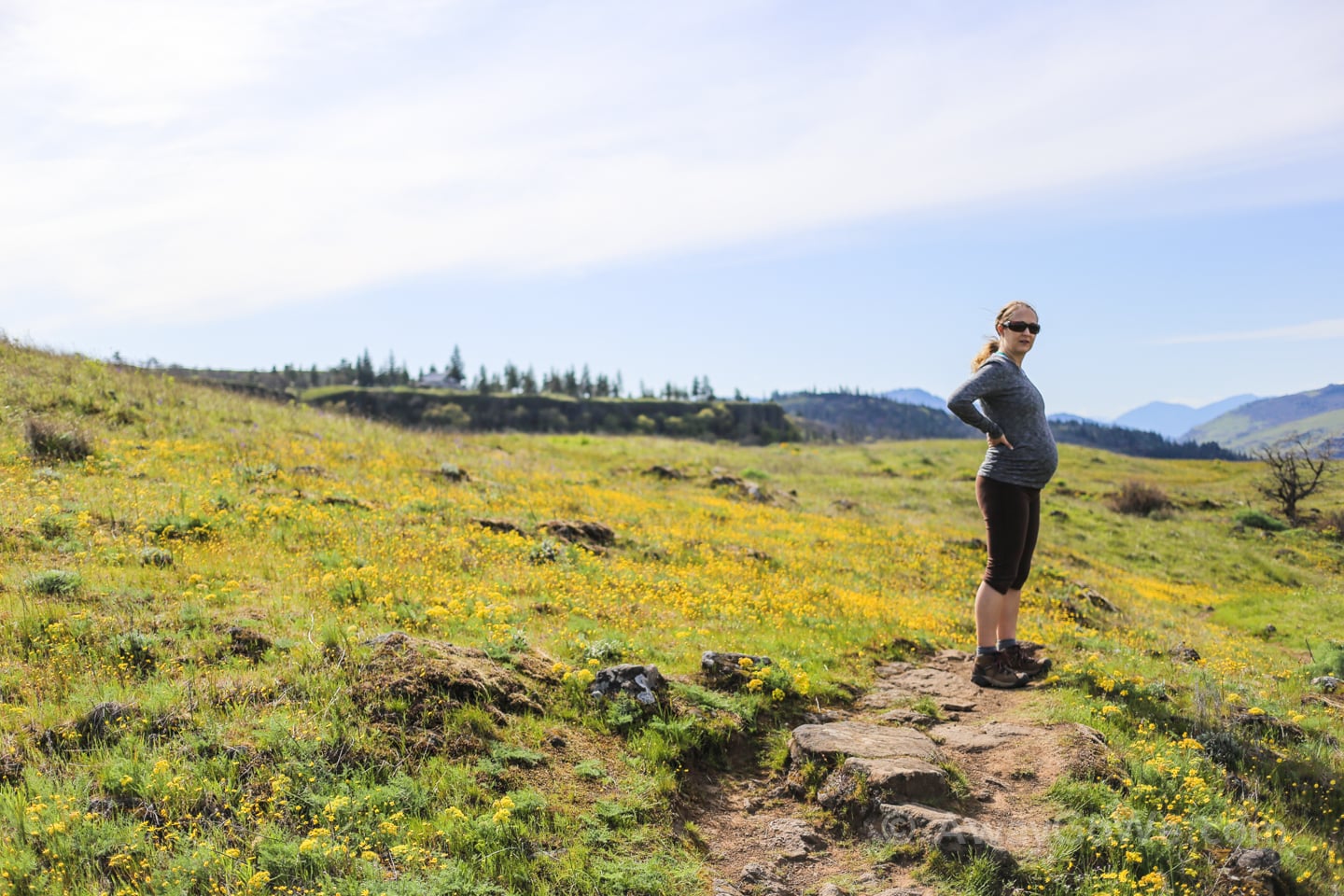
The wildflowers were out in full force today, which made me very glad I remembered my allergy meds before we left home.
Only a crazy person would attempt this hike this time of year without precautions, unless you are my wife who somehow has superhuman powers against evil seasonal allergens.
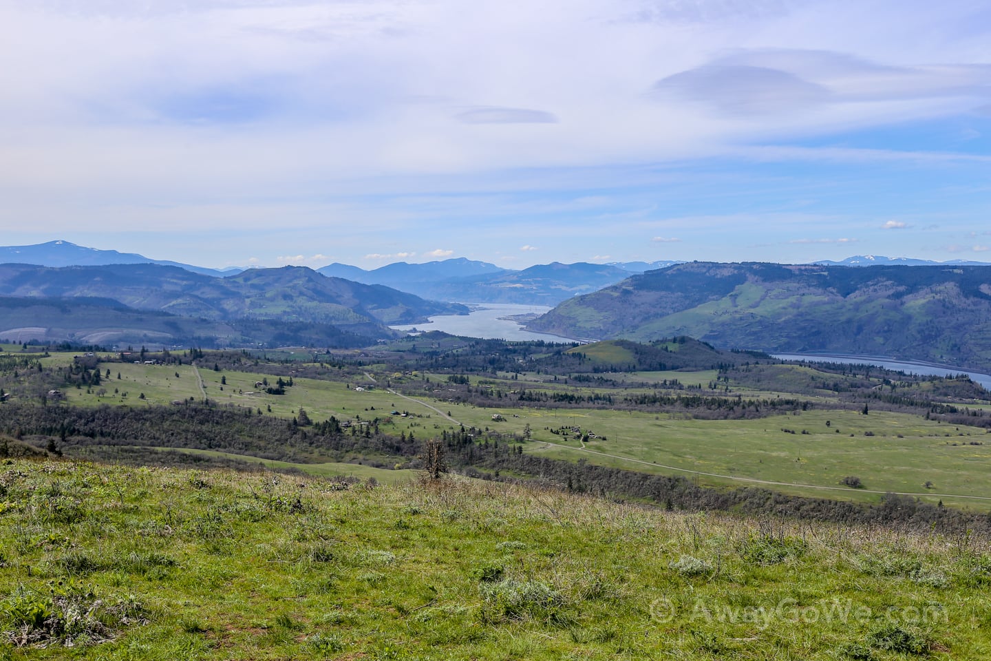
As we climbed higher and higher, Mt. Adams (across the river in Washington) gradually revealed itself.
Mt. Adams is the one area peak that we can’t see from our apartment (completely blocked by the 20-story building next-door), so we were particularly happy to be able to get to spend some quality time with ol’ Adams.
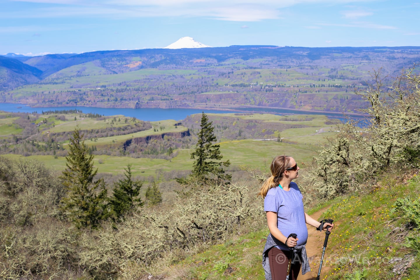
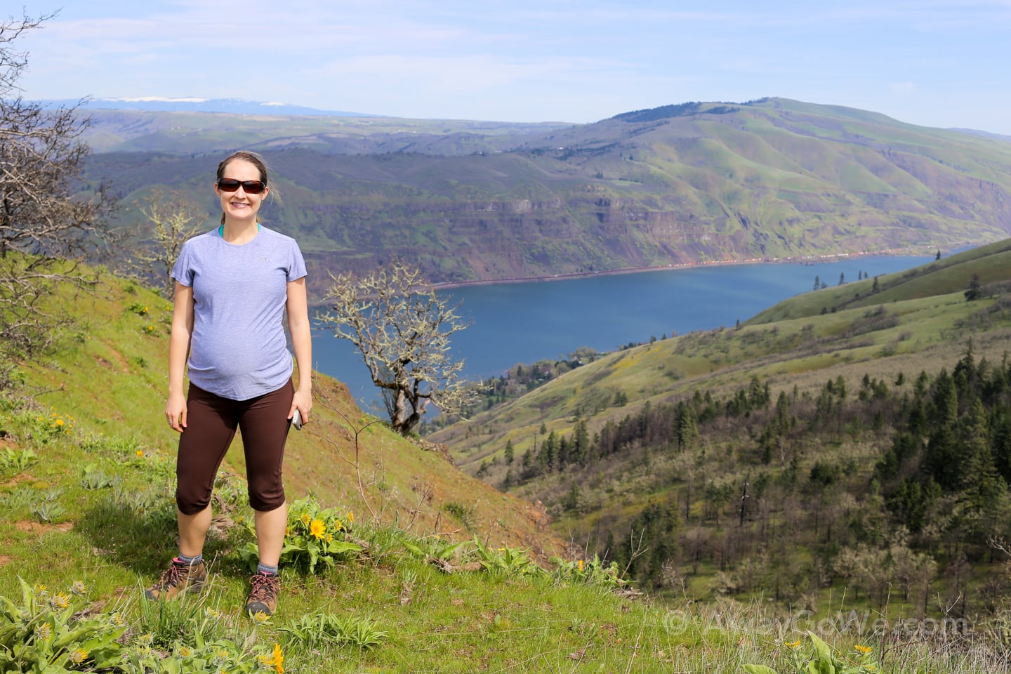
Pregnancy hasn’t slowed down Lori one bit.
Well, that’s not entirely true…we do break more for visiting Mother Nature.
Well, that’s not entirely true either…we break about the same as before, but now at Lori’s request instead of mine.
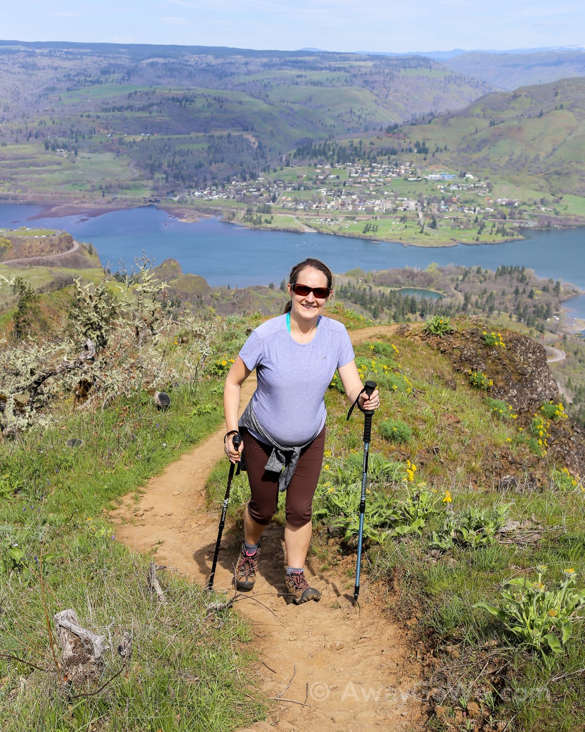
Almost to the top!

About halfway up the trail, Mt. Hood comes into view to the southwest.
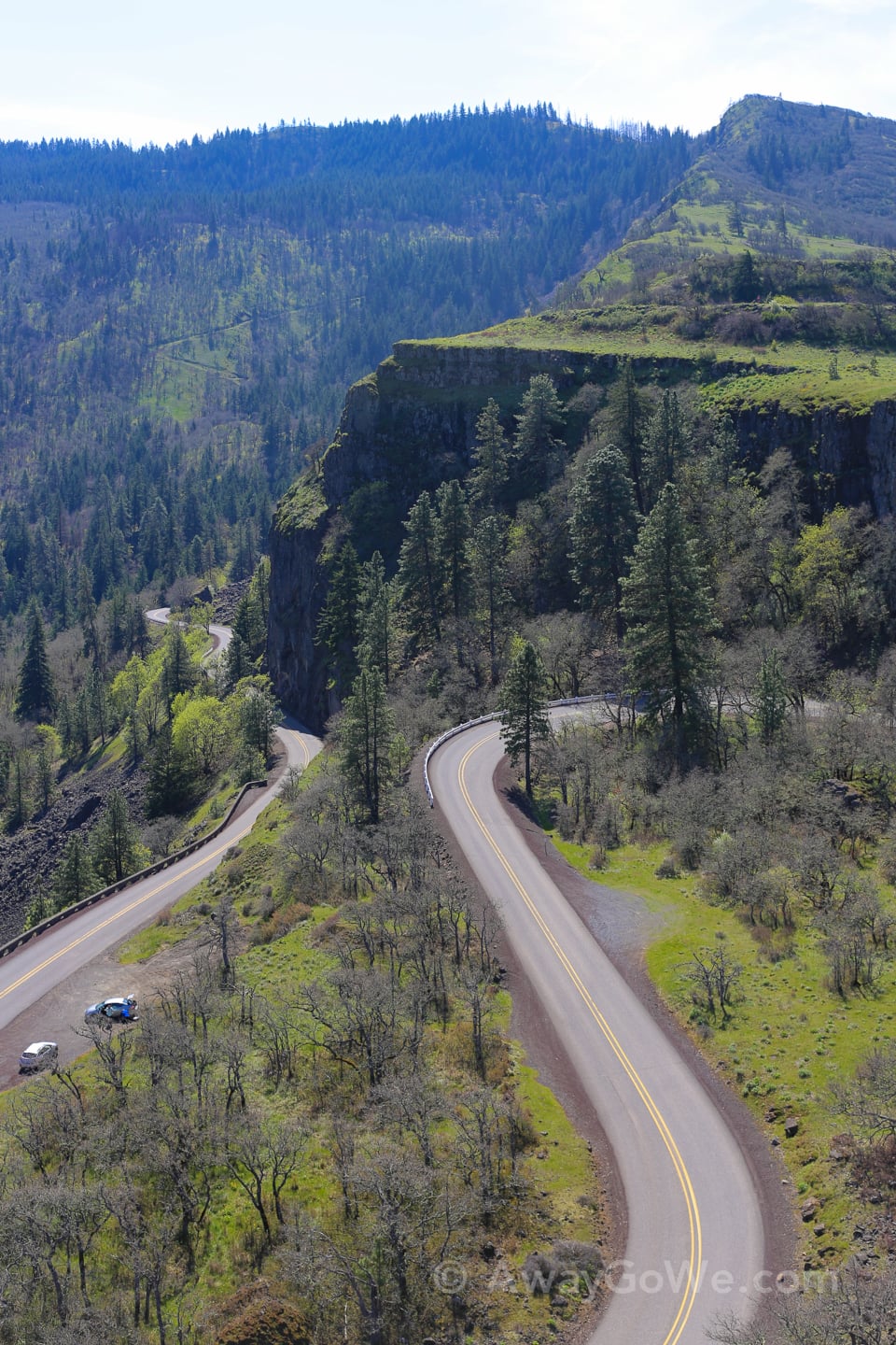
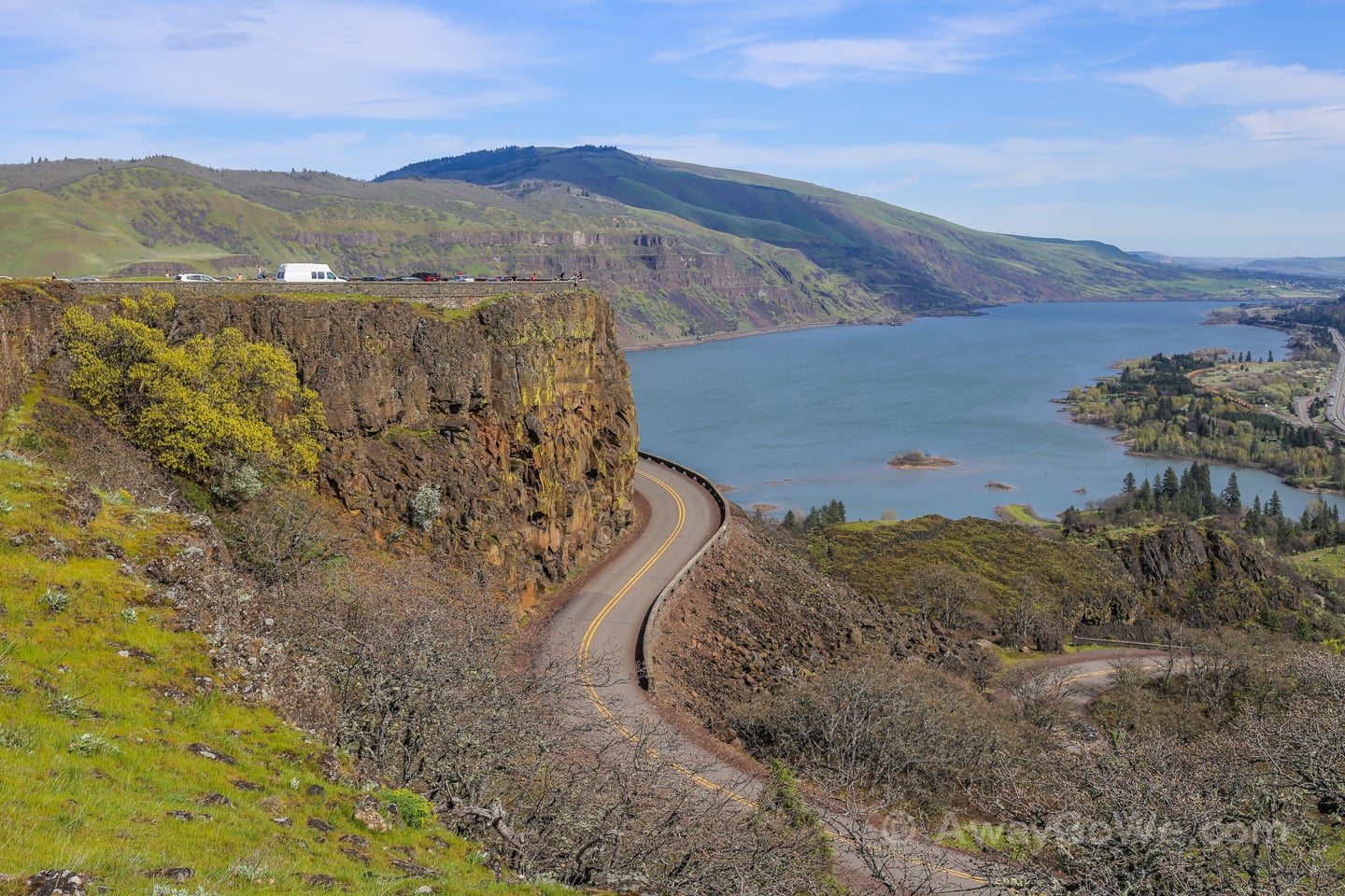
The previous weekend, we hiked Coyote Wall and the Labyrinth, which is located just around the bend in the river (see below).
Despite their proximity to one another, the two hikes are quite different.
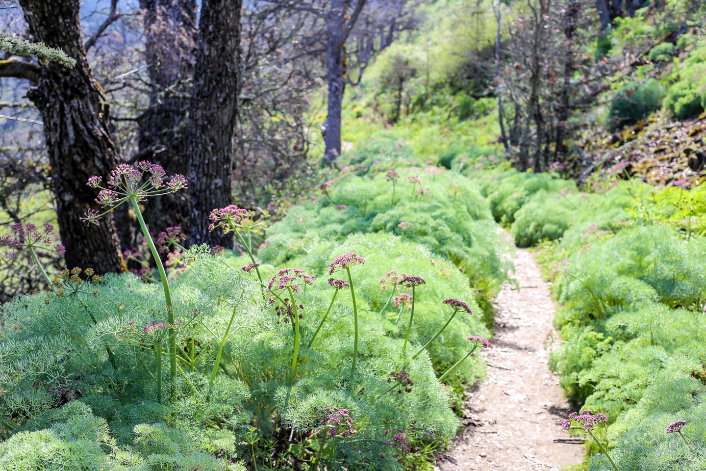
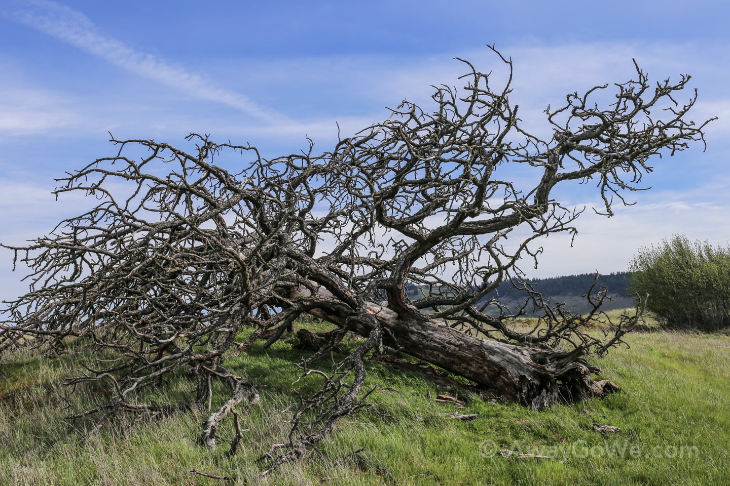
With the exception of the trailhead and summit, Tom McCall Point trail has a bit more tree coverage (though the trees are scraggily, wind blown looking things), and lots of scrub. The trail is largely made up of gentle switchbacks.
Coyote Wall, on the other hand, is wide-open and pretty much heads in a straight line to the summit.
There are also a number of mountain bikes and dogs that share the Coyote Wall trail. Dogs are not allowed, however, on McCall Point trail, with nary a biker in sight.
READ MORE: Essential Guide to Hiking Trillium Lake (And Losing the Crowd)
McCall Point hike has one other thing we didn’t see on the Coyote Wall trail: Snakes.
On our way up, Lori pulled off the trail momentarily to let some hikers pass and was startled by a sudden DA-DA-DA-DA-DA-DA sound.
She slowly took a few steps back over to me and calmly said, “Snake.”
I take a look over to where the sound came from and didn’t see a “snake.” I saw a HUGE FIVE-FOOT DIAMONDBACK RATTLESNAKE!!!
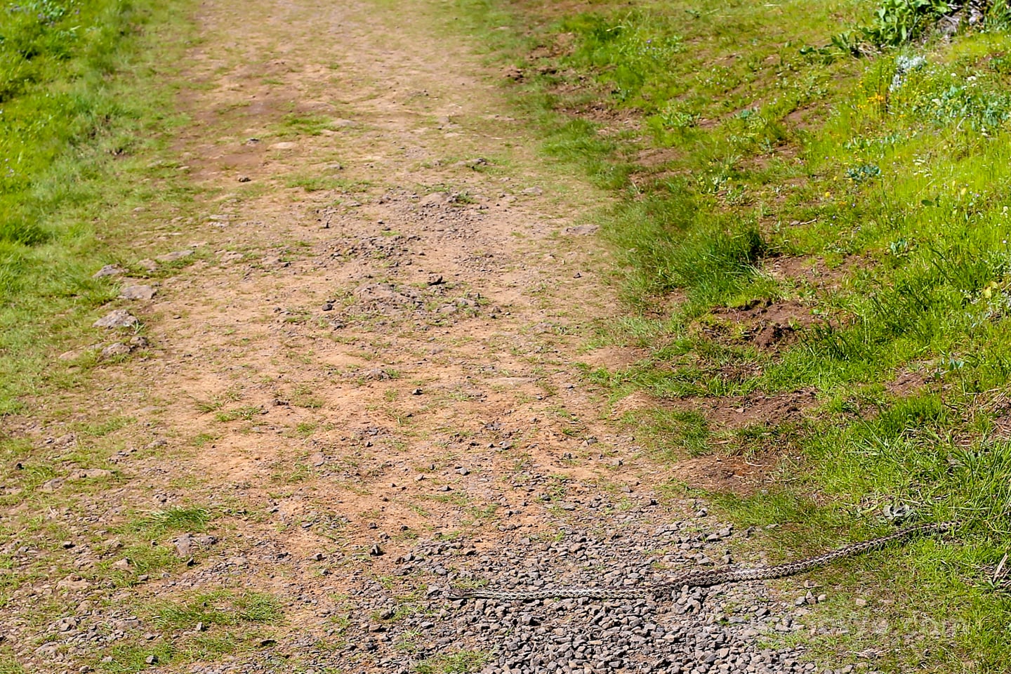
And NO, the photo above is NOT this snake, sadly, but yet ANOTHER snake (a harmless bull snake) that we encountered laying across the trail on our way back.
Yes, Diamondbacks are venomous, and yes, they can be deadly. But they rarely strike unprovoked, and nearly always use their rattle at a first.
Still, quite unnerving to know we got that close to Mr. Rattler’s “safe space,” but very cool to catch a glimpse of in the wild (from a safe distance).
READ MORE: Pittock Mansion Hike – Pure Bliss in the Heart of Portland
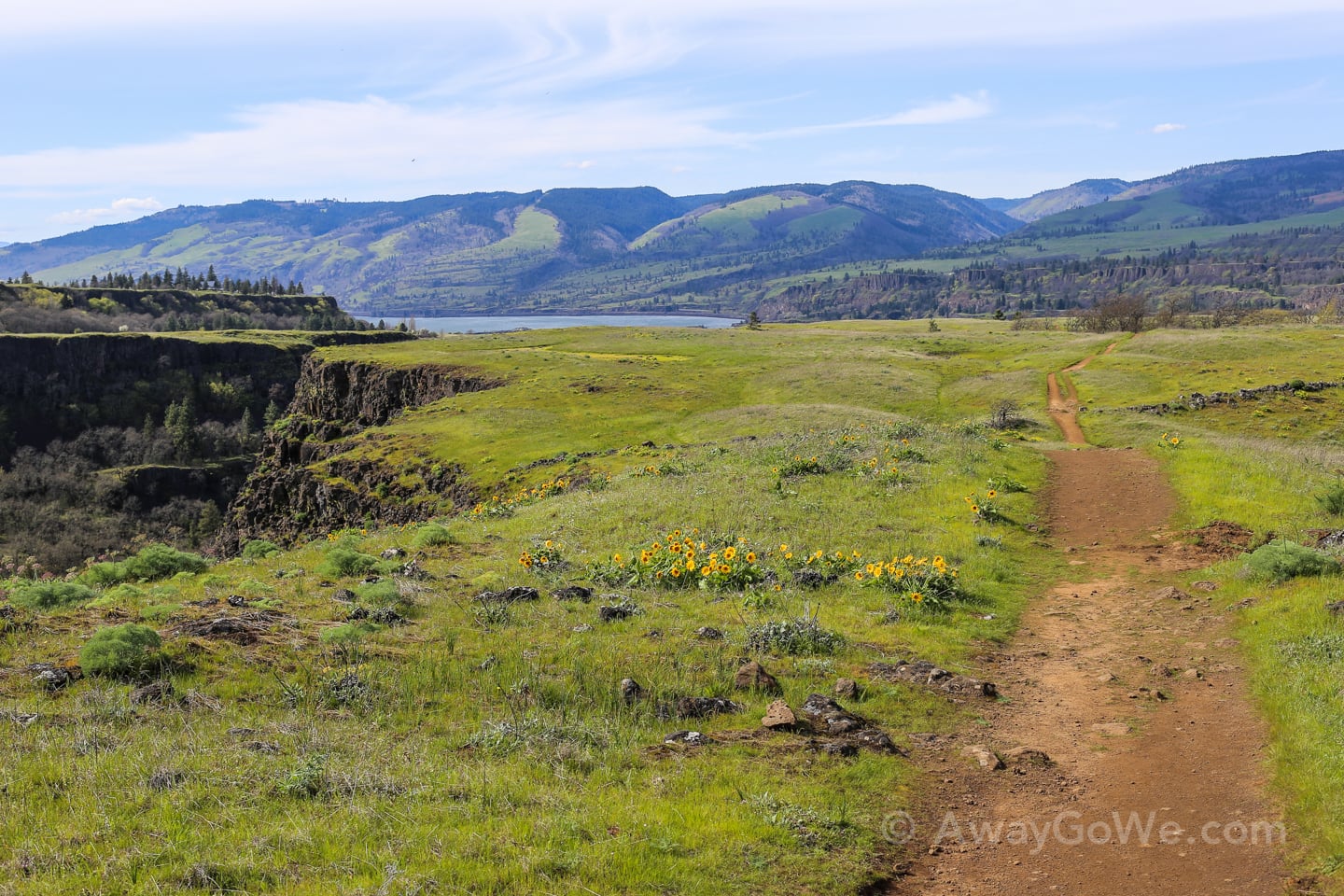
Rowena Plateau Trail
After our 3.5 mile and 1,200-foot climb — and encounters with not one, but two sizable snakes — we decided to tack-on the additional two-mile Rowena Plateau trail (loop), and are very glad we did.
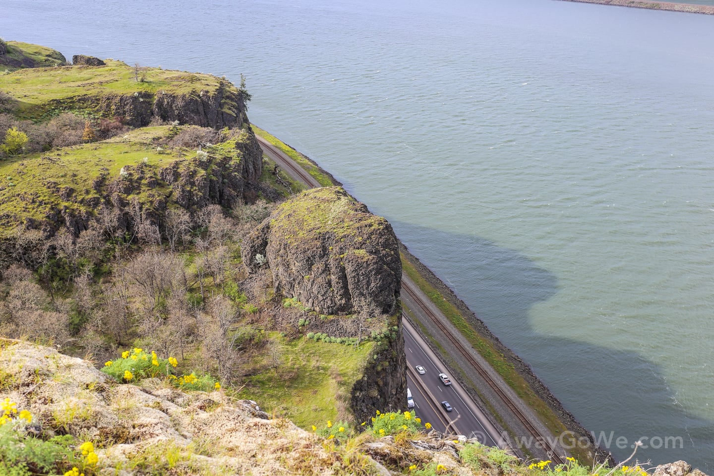
The Rowena Plateau trail is a much more leisurely jaunt, with very little elevation change, but incredible views, nonetheless!
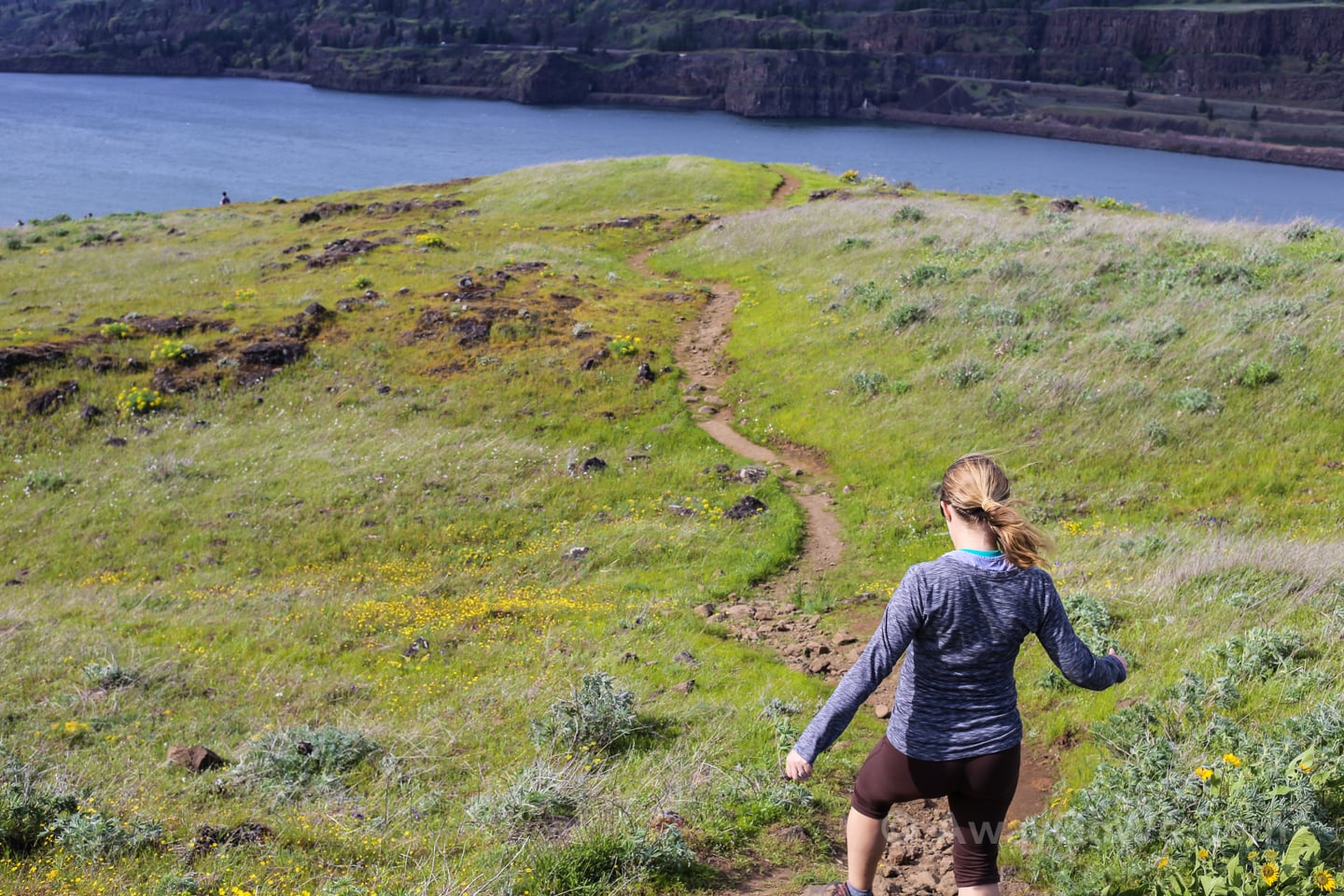
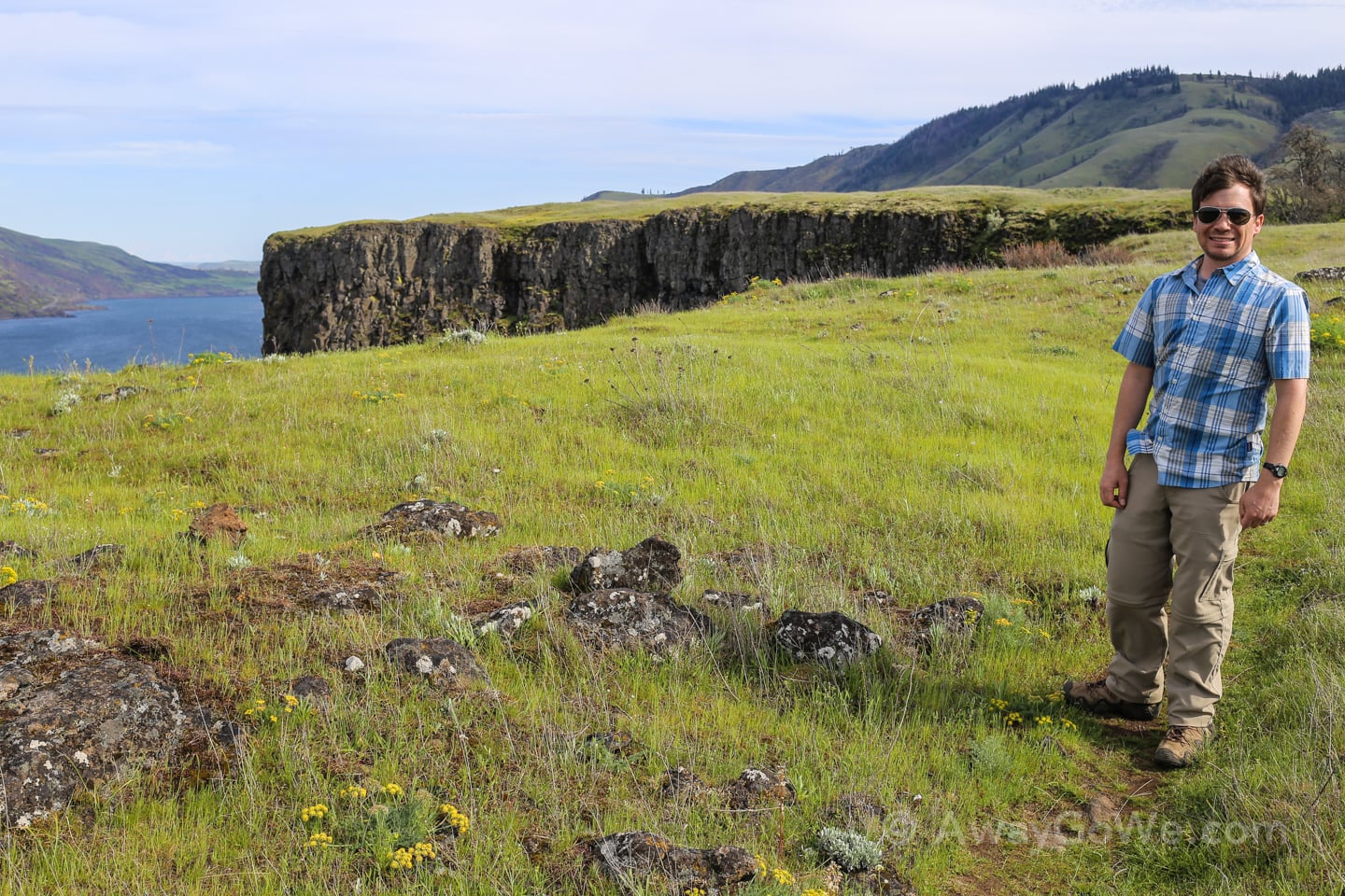
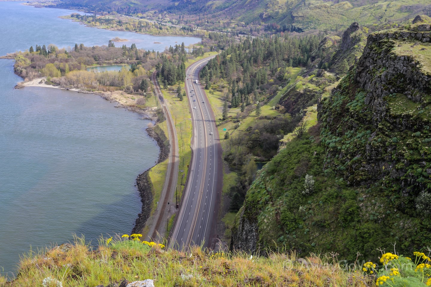
Oh, and it’s got some dizzying views of I-84, 500 feet below.
Discover More Great Oregon Hikes
Portland Area
- 4T Trail: Discovering Portland’s Quirkiest Urban Hike
- Pittock Mansion Hike: Wildwood + Lower Macleay Trail
- Portland’s Alameda Ridge Stairs: Our First-Hand Guide
- Leach Botanical Garden: Portland Hidden Wonder
Around Oregon
- Trillium Lake Hike in Oregon: All-Season Visitor’s Guide
- Cape Kiwanda: A Guide to Hiking + Visiting
- Cape Blanco State Park: Why Visit + What to Expect