Monkey Mountain (Cerro del Mono) is a favorite hike among locals and visitors near Sayulita, Mexico. Easily conquered in half a day, this hike can be accomplished with a local guide or on your own with a good map and some preparation.
In this detailed hiking guide, we’ll explain how to hike on your own from Higuera Blanca (the most common route) or Sayulita with the most up-to-date map on the web, plus tips on what to pack, when to go, and more.
We’ll also share our own trip report with plenty of photos, and offer recommendations for local guides and reputable tour operators that run day trips to Monkey Mountain.
Looking for more jungle adventures near Sayulita?
▸ If a high-adrenaline adventure (and workout) is what you crave, we recommend doing a single-track mountain bike adventure in the dense jungle just outside of town.
▸ For something a bit more laid back, jungle horseback riding excursions offer a great way to see much of the same scenery, but at a different pace.
This post contains affiliate links. If you click and make a purchase, we might receive a commission (at no added cost to you). Thanks for supporting independent, ad-free blogs!
About Sayulita’s Monkey Mountain Hike
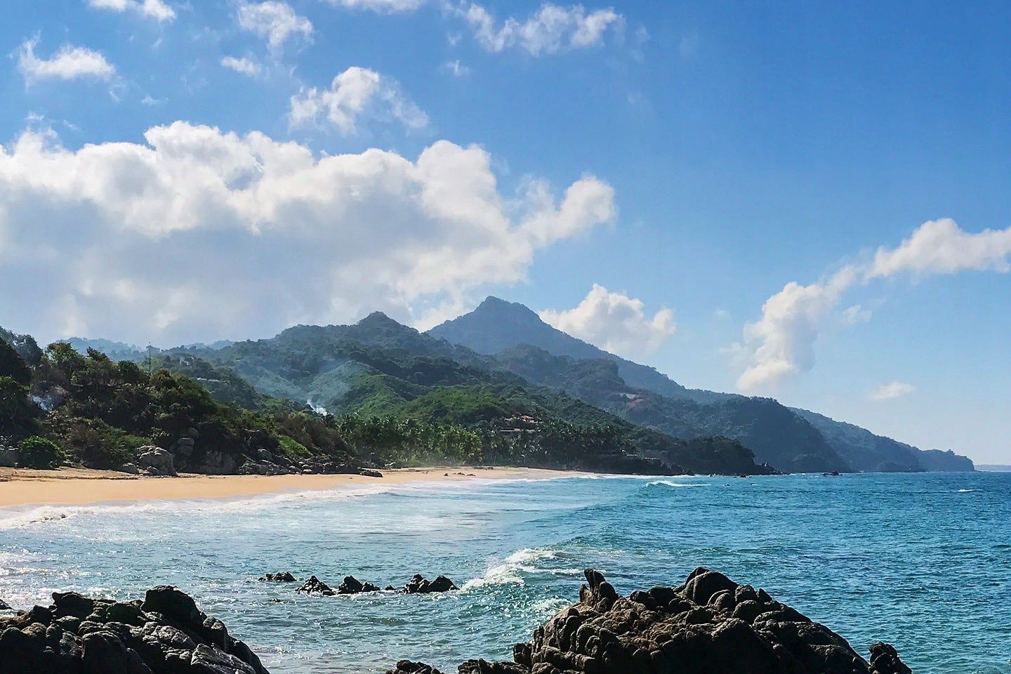
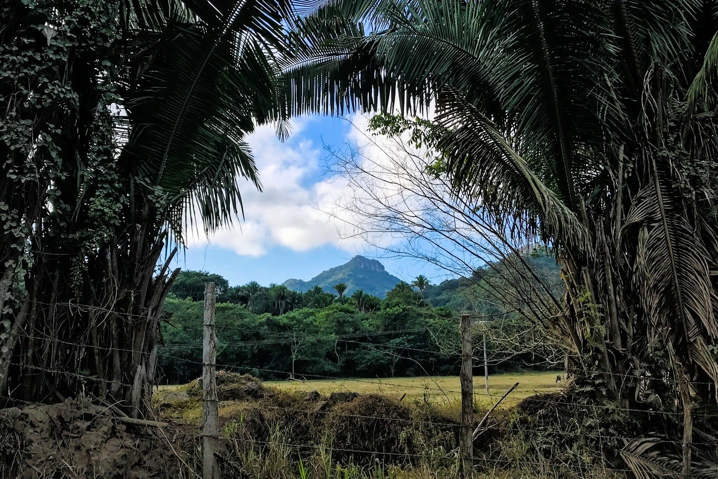
Why climb Monkey Mountain (aka Cerro del Mono)? Hikers can look forward to a breathtaking 360-degree views of the Pacific coastline, Punta de Mita, and inland mountains (and a pretty good workout!).
The hike is out-and-back, with a distance of just over 2 miles each way from Higuera Blanca central plaza (4 miles roundtrip).
We’d rate this hike as easy-moderate for the first mile, and moderate-strenuous for the second mile, due to some steep segments and the 1,050-ft. ascent.
The first 1,000 feet of elevation gain is made gradually over two miles. The last 50-ft. ascent is a straight-forward boulder scramble to the top.
You don’t have to be in top shape to hike Monkey Mountain, but the better shape you’re in, the more enjoyable this hike will be for you.
How to Find the Hike
Cerro del Mono is located in the state of Nayarit, just outside of the small town of Higuera Blanca.
The hill lies about four miles south of Sayulita and five miles north of Corral del Risco (Punta de Mita), as the crow flies.
Monkey Mountain is one of the highest geological features in the area, hemmed in between the Pacific Ocean to the west and Federal Highway 200 to the east.
Want to Learn to Surf in Sayulita?
Sun, sand, sea, and sublime scenery, there are few better places in Mexico to catch your first wave.
▸ We recommend doing a beginner’s surf lesson with Wild Mex, one of Sayulita’s top surf schools.
Time Commitment
Hiking Cerro del Mono from Higuera Blanca town generally takes about 2-3 hours roundtrip, depending on fitness and pace, weather, trail conditions, and how long you linger on the summit.
Add an additional 20 minutes each way for driving to/from Sayulita, and 10 minutes driving to/from Coral del Risco (Punta de Mita).
Hiking Monkey Mountain from Sayulita town entirely on foot is possible, but takes considerably longer, mostly depending on where you choose to start, how well maintained the trail is, and weather conditions.
Expect a solid 3 hours of quasi-bushwhacking from Hacienda Jaqueline at KM 5 near Playa Patzcuaro, and an additional 1+ hours each way to/from central Sayulita.
Should I Go With a Local Guide?
If you’re well prepared, up for an adventure, and got your transportation in order (or prepared for a very long day hike from Sayulita), then doing the hike on your own might be a good option.
However, if this is your first visit to the area, you’re pressed for time, or simply don’t want to deal with transport or a full day hike, you’ll probably want to hire a local guide to take you.
Check out Mita Adventures (Punta de Mita), Mexitreks (Sayulita), and Wildmex Surf & Adventures (departures from Sayulita and Punta de Mita).
And read on for our full hiking report to get an idea of how to prepare and what to expect, plus important tips and advice if you decide to hike on your own.
When to Hike Monkey Mountain
Cerro del Mono can be hiked year-round. But the hike may be most enjoyable in dry season (between November and May), as trails can get very muddy and slippery in the summer months and visibility at the top can be poor.
You’re likely to get your best views at the top between January and May, and coolest weather between December and March.
As a reference, most of the photos you see here were taken in early March.
The hike is popular around the year, but especially during the Christmas holiday and Easter (Semana Santa) holidays. Weekends (particularly Sundays) can get very crowded with local families visiting as well.
Outside of holiday season, midweek is best. Start as early in the day as possible to beat the heat.
Just before sunset is a spectacular time to summit, but it can also get busy around that time (and the summit is very compact).
Be sure to bring a headlamp for the return journey if you plan to stay for sunset.
Hiking with Kids
Older children (8+) may do just fine getting to the top, particularly ones with lots of hiking experience.
The first 2/3 of the route from Higuera Blanca is suitable for most ages and abilities.
However, we would not advise younger children attempt the boulder scramble near the summit due to often windy conditions, large gaps between boulders, and sheer drops.
Trail Map
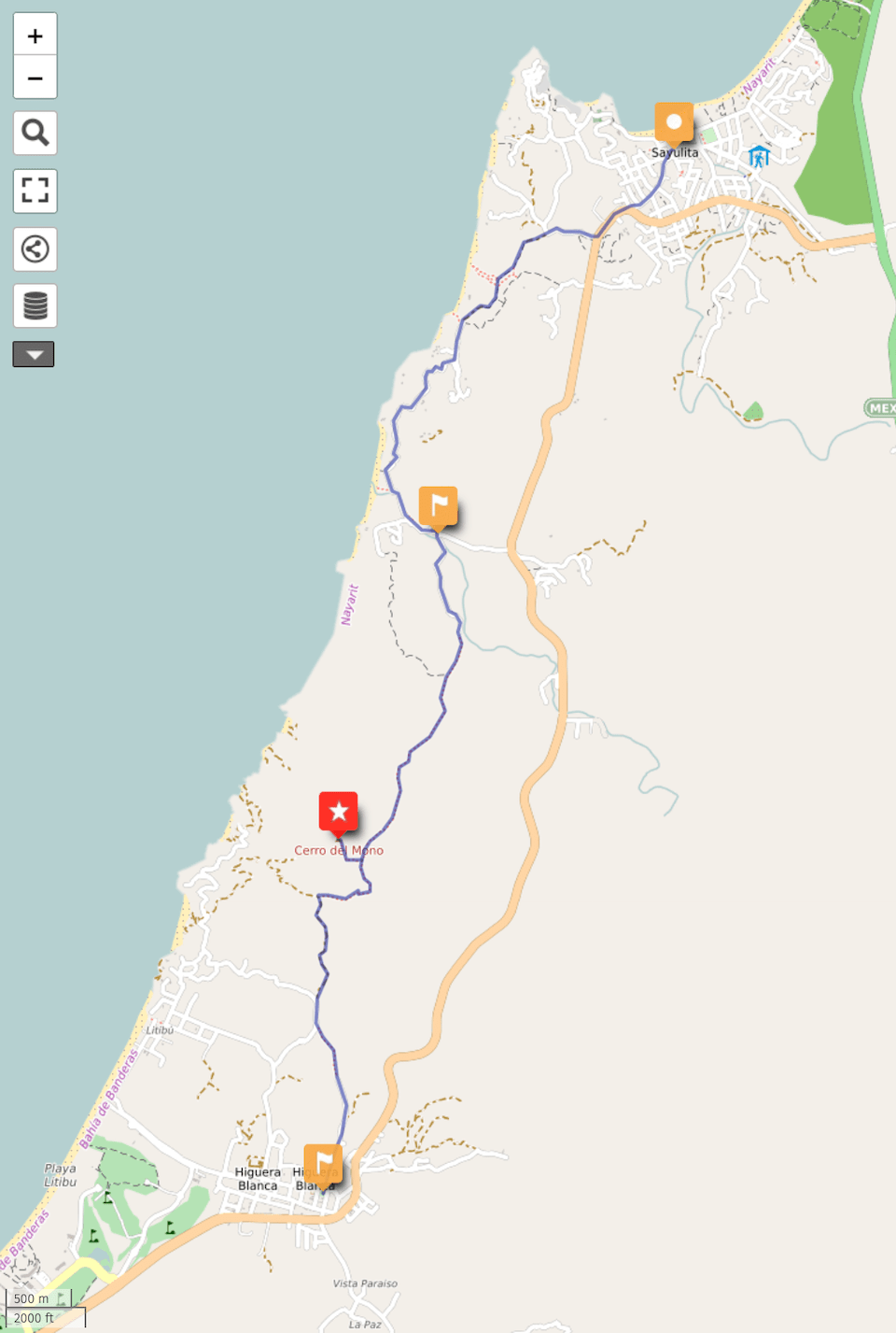
The above map shows the routes from Higuera Blanca to Cerro del Mono, and Sayulita to Cerro del Mono via KM 5, current as of mid-2021.
Use the map to navigate in conjunction with our trip report, below.
You could also download a hiking map app to use on your device. We love the Gaia GPS app for mobile, which uses OpenStreetMap.org (OSM) open source maps. OSM is an awesome crowd-sourced resource for trail maps, where Google maps tends to focus on streets.
We’re also big fans of AllTrails.com which is useful for getting the latest intel in English on doing this hike and others in the area.
🔥 HOT TIP 🔥
In early 2021, new fencing was erected along the southeastern side of the last bit of trail before you start to ascend the south spine of Cerro del Mono.
If you are hiking from Higuera Blanca, this should NOT impact your hike.
However, if you are hiking from KM 5 / Sayulita, note that the last bit of the route has shifted. Our map (and OSM/Gaia GPS) has the correct route. If you follow the old route, you may find yourself staring at barbed wire just minutes from summiting.
Hiking from Higuera Blanca
Transport from Sayulita to Higuera Blanca
After studying the map and reading a number of hiking reports online, we opted for taking a taxi from Sayulita to Higuera Blanca and starting and ending our hike there (we’ll explain more on why in the Hiking from Sayulita section later on).
In retrospect, we were very happy with our decision, particularly since we had to be back to Sayulita by 1:30pm and got lucky getting an Uber in Higuera Blanca back to Sayulita.
🔥 HOT TIP 🔥
Transport from Higuera Blanca to Sayulita can be extremely difficult to arrange on the spot.
While there are regularly scheduled buses between Higuera Blanca and points south (Coral del Risco, Cruz de Huanacaxtle, Bucerias, etc.) there is no regular service (that we could determine) between Higuera Blanca and points north (Sayulita, San Pancho, etc.).
Unlike Sayulita and San Pancho, Higuera Blanca does NOT appear to have a taxi park either. We got lucky using our Uber app and hailing a driver dropping off someone at nearby Litibu Resort, but we have the feeling we got very lucky.
If you’re staying in Sayulita and doing the hike on your own starting in Higuera Blanca, we highly recommend arranging a roundtrip journey with a taxi or driver in Sayulita (who will wait for you in HB and bring you back). Or, going with a guide who will arrange transport for you.
Higuera Blanca to “Paradise Lost” Waypoint
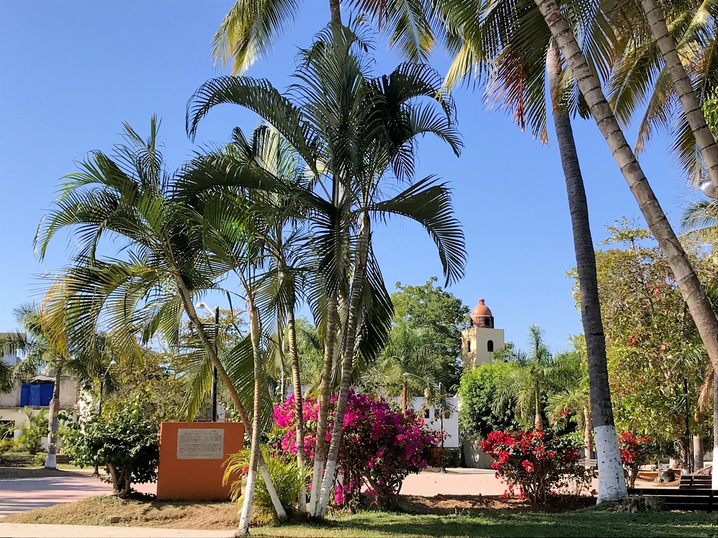
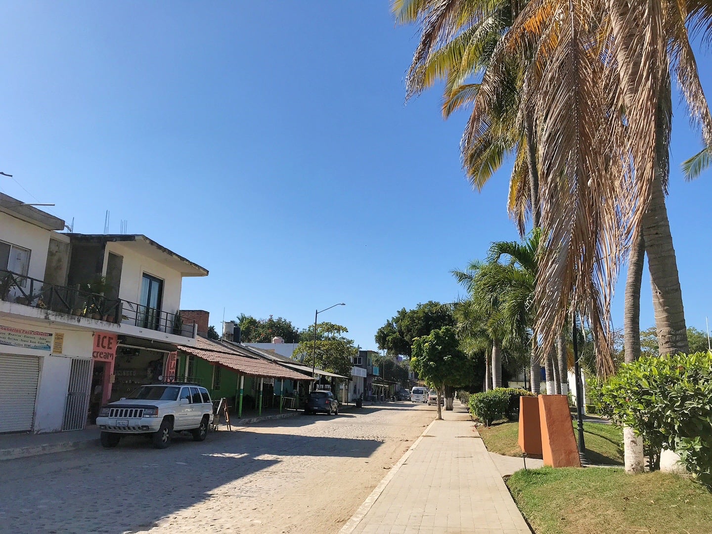
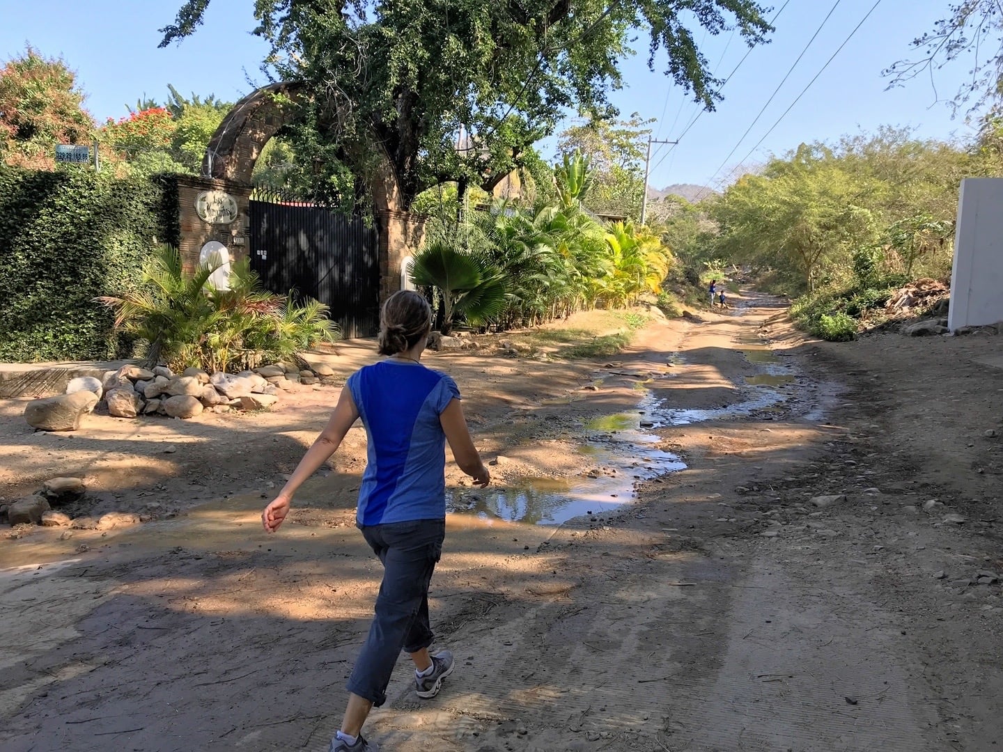
Higuera Blanca is a nice town to stroll around for a bit.
A few things that struck us during our first visit was how large the town is (we certainly weren’t expecting a proper central plaza and church!), how tidy and put together it seems, how quiet and chill it (compared to Sayulita or San Pancho), and how far set-back it is from the beach (about a mile).
We started our hike where most hikers seem to start – at the central plaza. If you happen to be coming from Bucerias and take the bus, it should drop you off here.
From the plaza, we set off north along Calle Juan Escutia. The town arroyo passes right over the road. But no worries, the wash is not terribly active outside of rainy season.
And the good people of Higuera Blanca have constructed a pedestrian bridge for those wet summer months.
After that, the road quickly turns into a dirt track with a gradual incline and Monkey Mountain visible in the distance.
This guy may be the closest you’ll get to seeing a monkey on this trek.
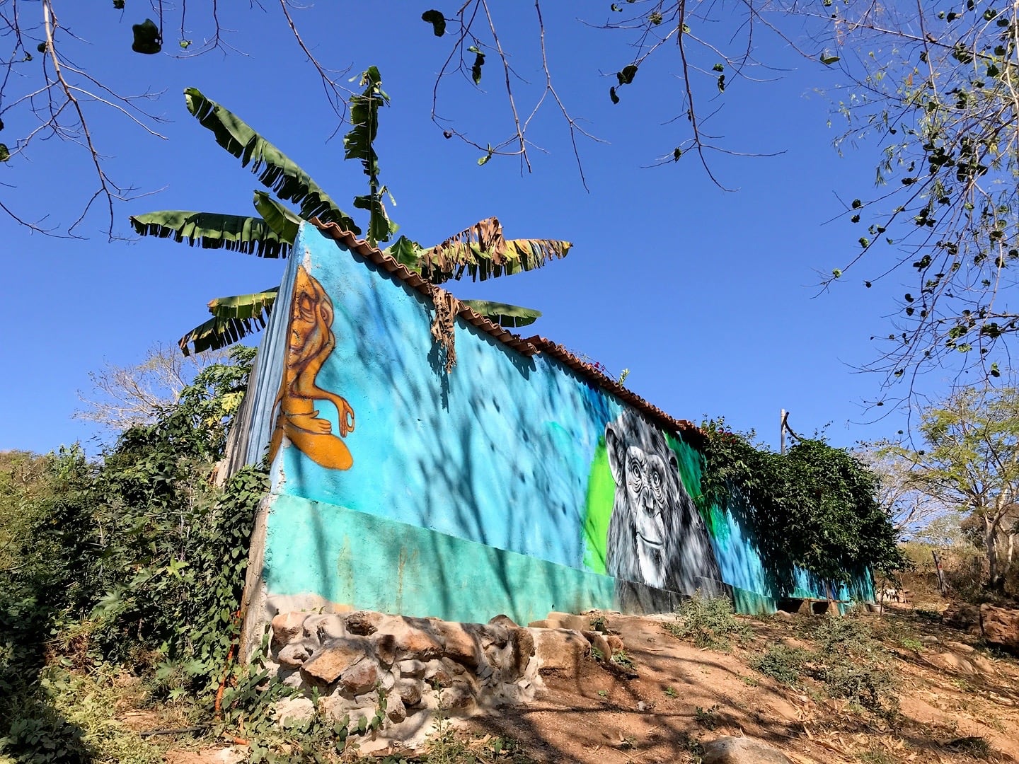
There seems to be little consensus regarding the origin of the name Cerro del Mono (Monkey Mountain), but most locals will be quick to tell you there are most certainly no monkeys on Monkey Mountain. Now that we’ve cleared that up, onward!
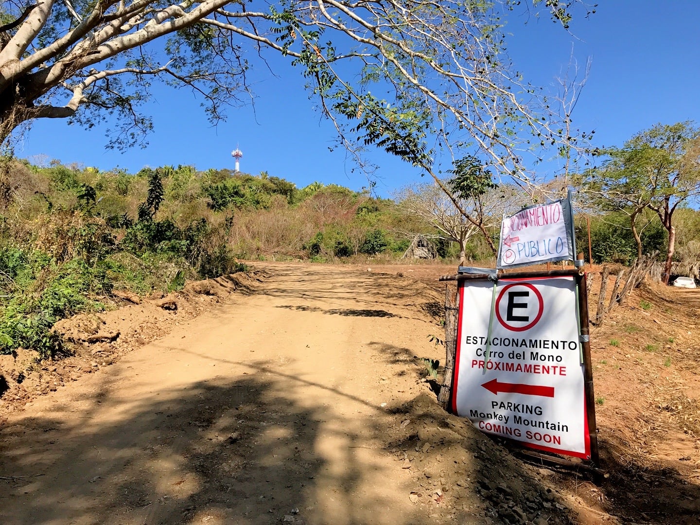
“Coming Soon,” parking for Cerro del Mono. We’re really hoping this is just the property owner hoping to make a few bucks on the side and not part of a larger effort to exploit the hike by bussing in loads of tourists.
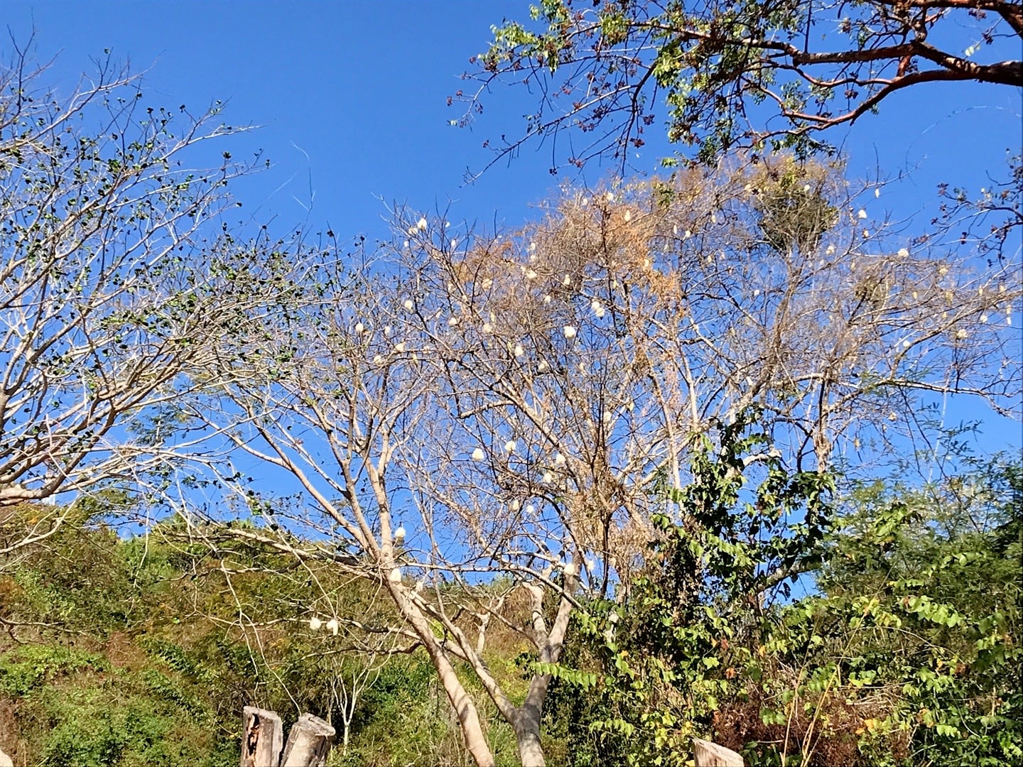
Cotton Tree.
After a short while, the dirt track veers left, narrows, and deteriorates into a footpath.
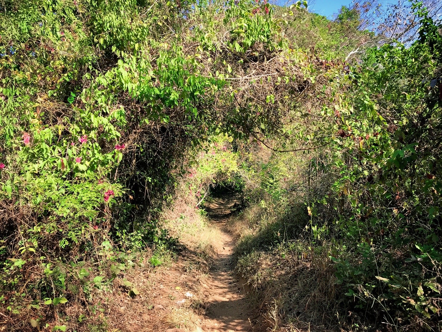
Into the jungle!
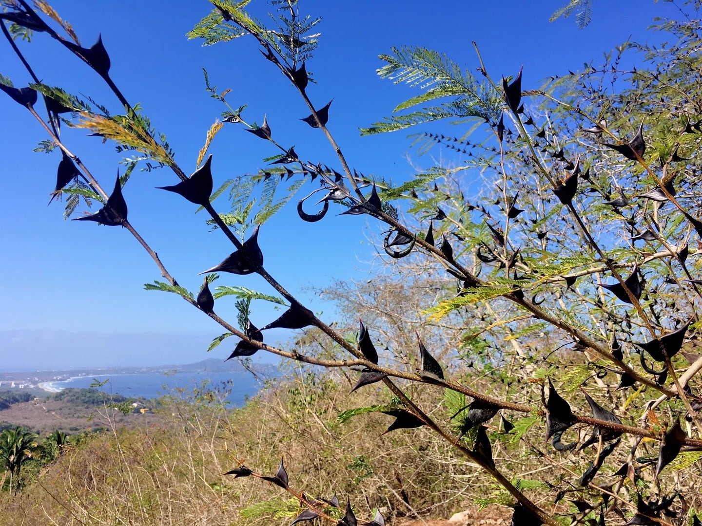
Here in the dry season, it’s looking more scrubby than jungly these days. But we’ve heard plenty of reports (and been on enough hikes around Sayulita in rainy season) to know that isn’t always the case.
The forest in this area does get crazy lush with a little bit of rain.
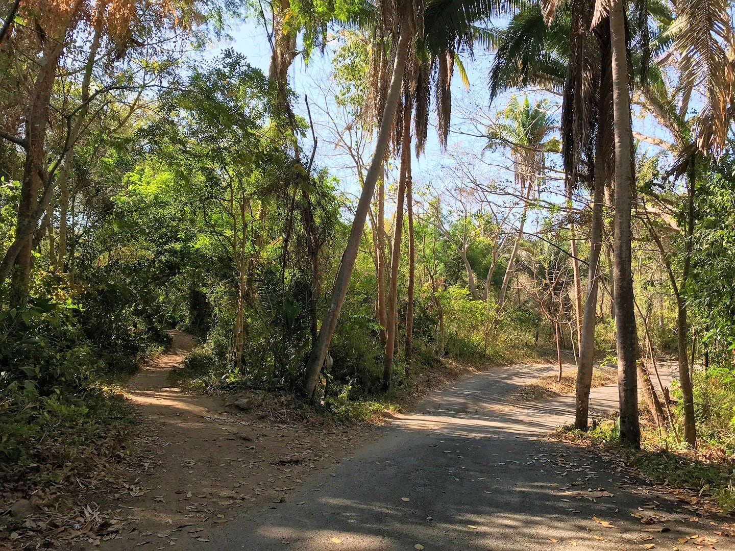
The footpath suddenly dumps us onto a blacktop road. A bit of a surprise in the middle of the jungle, and it appears to be a newer development as well. This photo is looking back towards the path we just arrived on (on the left). We head right along the sealed road until we come upon a cattle fence.
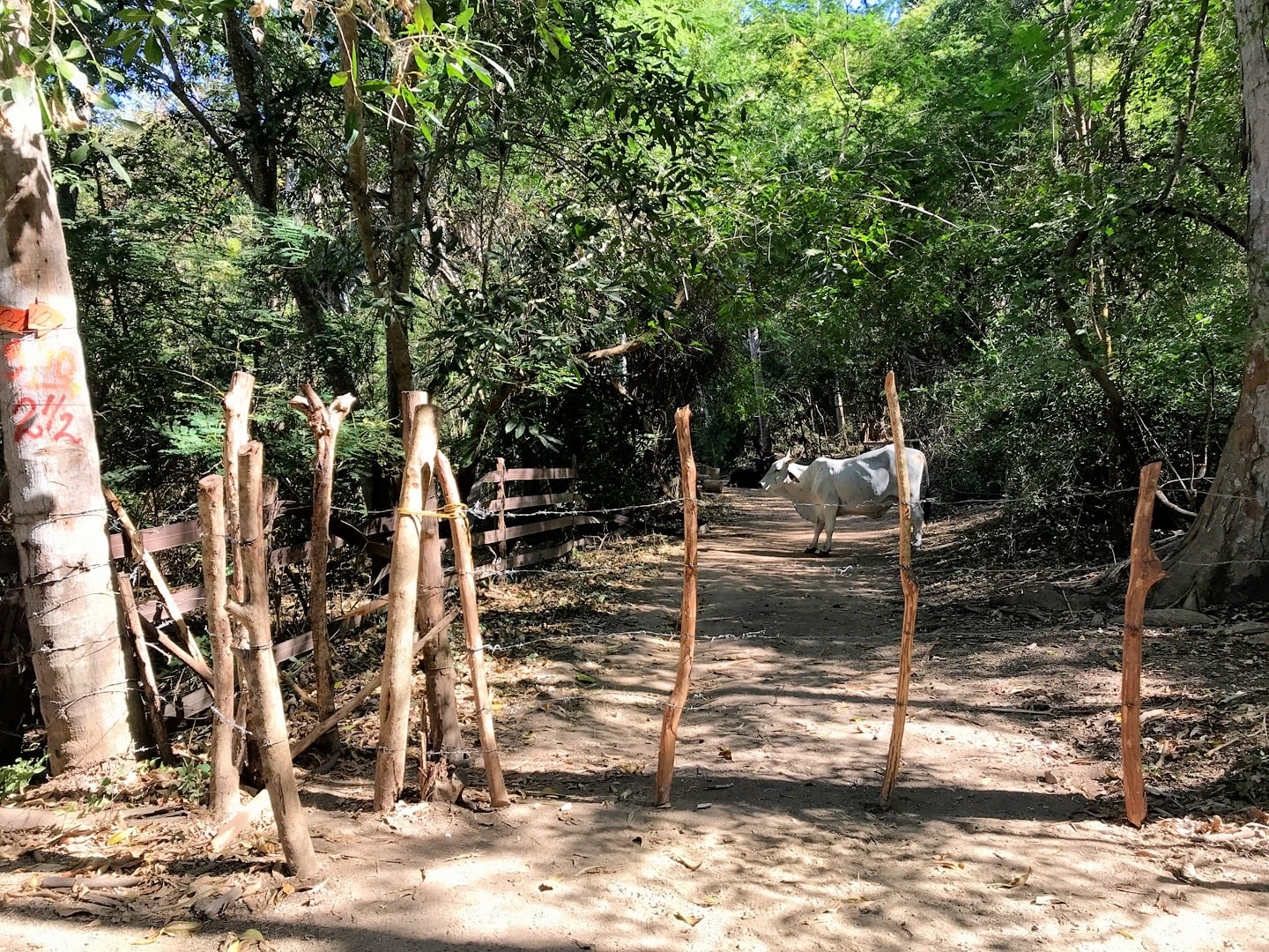
We leave the sealed road, turning right onto another dirt track where a group of cattle are resting in the shade. We weave our way through the cattle fence, and carefully make our way around the lazy cattle.
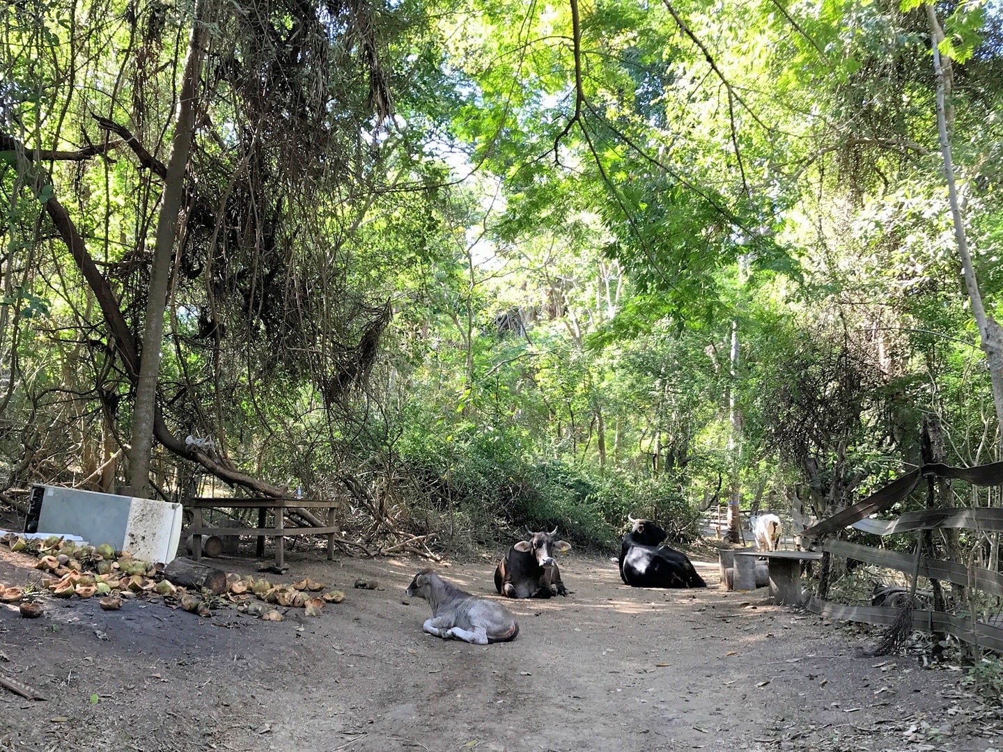
Fortunately, they don’t seem to mind too much that we’ve invaded their territory.
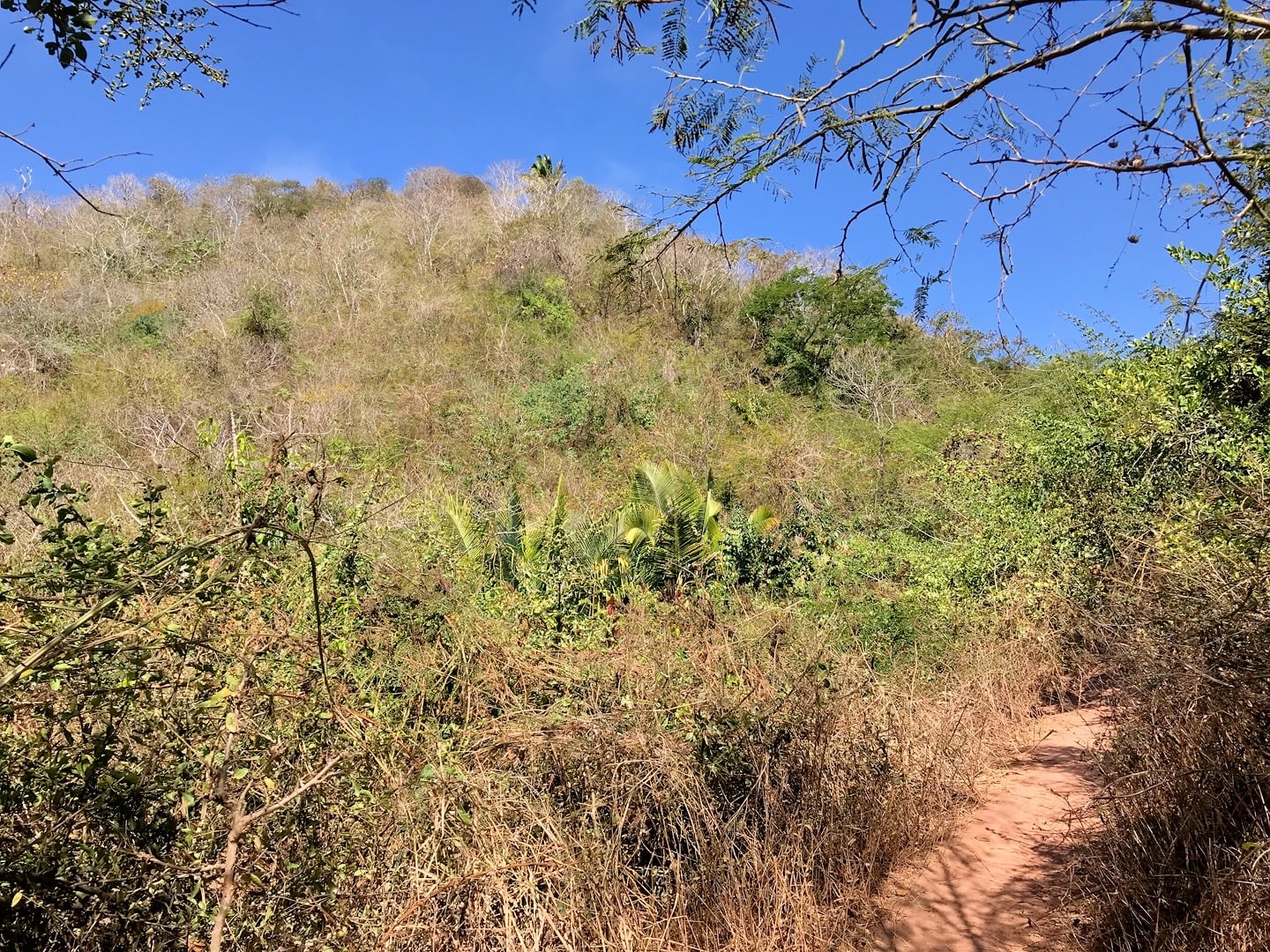
Soon, the trail leaves the tree cover behind and we find ourselves following an exposed path. At this point, we’re finally starting to gain some elevation, evidenced by the view we now find ourselves with looking south.
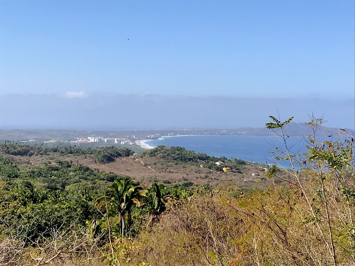
Onward and upward.
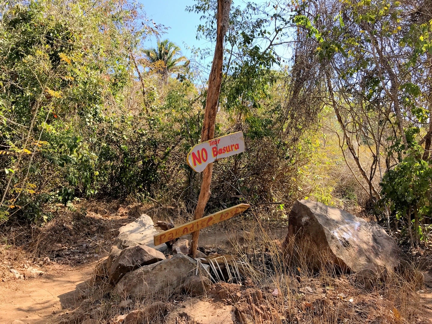
“Paradise Lost” Waypoint to the Summit
Not long after leaving the viewpoint on the left, we reach our next waypoint on the right. No trail signage, just No Tirar Basura (No Littering) and “Paradise Lost.”
This is the way.
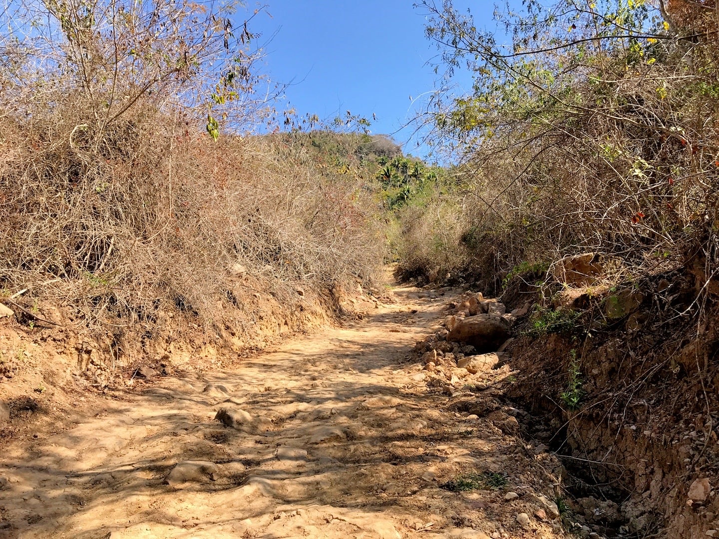
Next, the path drops into dense jungle, down into a gully, then onto one of the steeper sections of the hike. This is pretty slick and sandy today. We haven’t seen any rain here for a couple of months now.
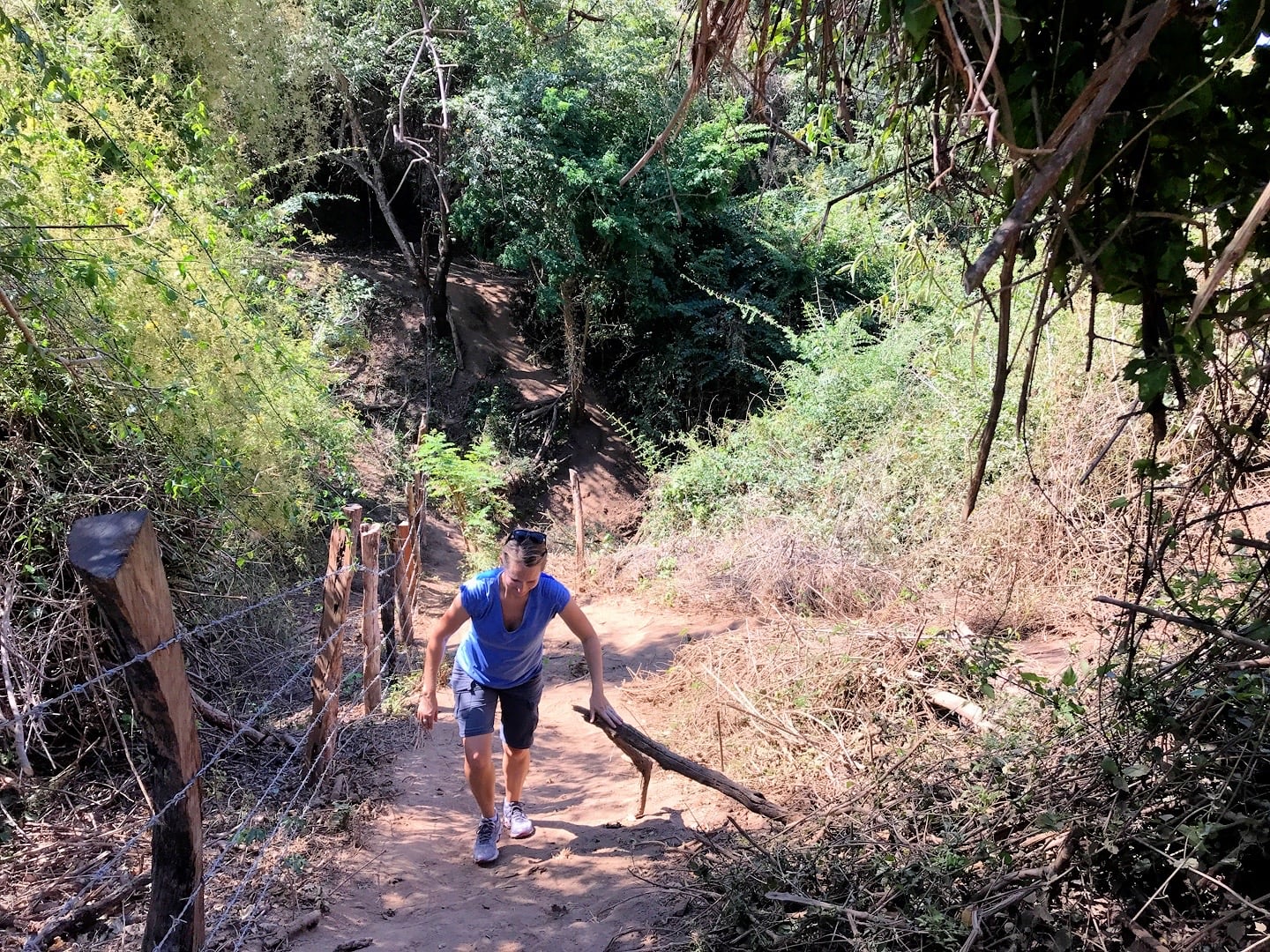
The barbed wire fence in this photo is a recent addition. It had no impact on our hike from Higuera Blanca to the top of Cerro del Mono. However, it has altered the route from KM 5 / Sayulita, as this is where the trail from the north used to join up with this trail.
As previously mentioned, the trail from KM 5 / Sayulita now connects a bit farther north (very close to where the trail starts ascending rapidly near the summit). We actually encountered a local family stuck on the other side of the fence trying to get through. They were just as surprised as anybody at this new development.
Our map, above, and OpenStreetMap.org (as well as the Gaia GPS map) has the updated route.
Getting closer!
We follow the dusty path ever higher until finally, we round a corner and spot the telltale sign that the summit is within reach – the boulder scramble.
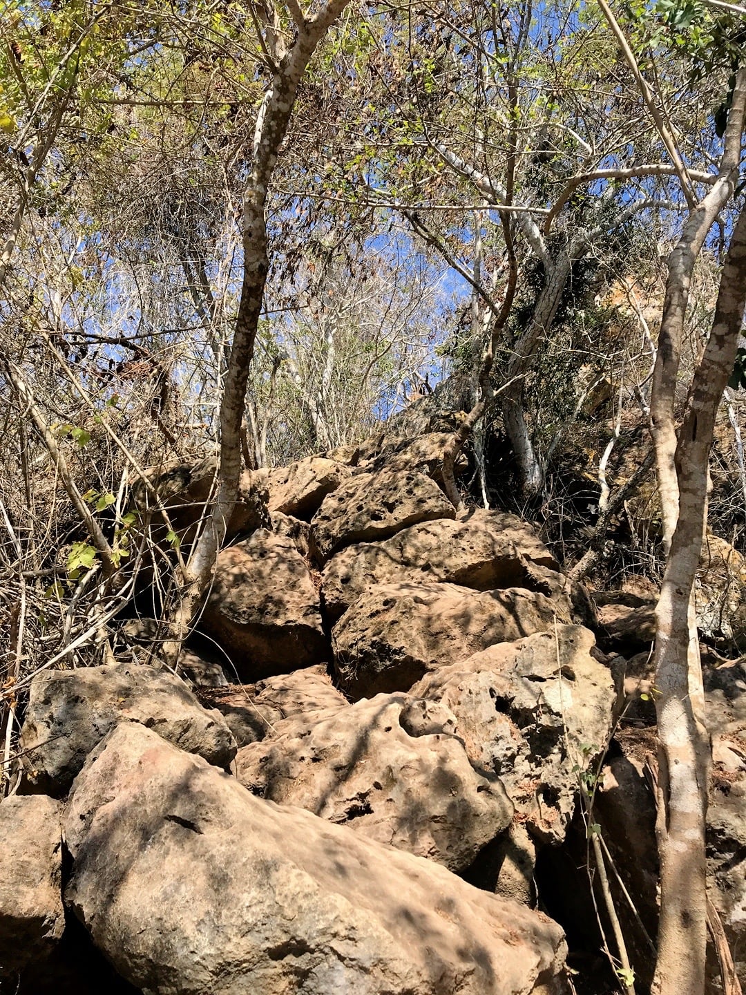
We head to the left, which at first, doesn’t appear to lead anywhere. Just over the rise, we spot a clear path forward and up. We essentially ended up doing a corkscrew ascent in a clockwise direction, which appeared to be the easiest route to the top.
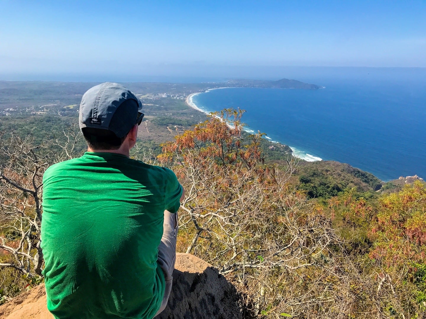
We made it!
Summit of Cerro del Mono
We were treated to clear skies and minimal haze (dry season can get hazy from burning), with only a bit of a bank sitting over the Bay of Banderas just beyond Punta de Mita.
Many of the trees and shrubs around here lose their leaves in dry season, offering less obstructed views than we would expect to have between July and December.
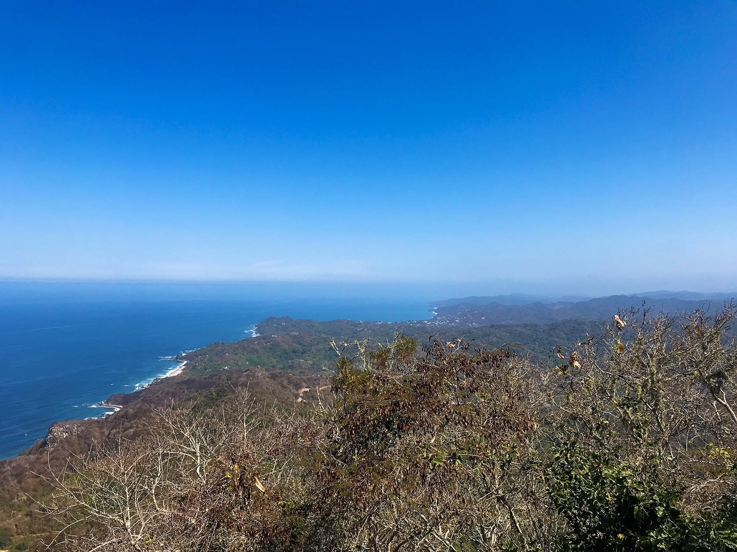
From here, we get a 360-degree view, from the mountains to the coast. Some pretty incredible beach homes perched on the cliffs below also catch our eye, as does the very conspicuous Iberostar Selection Playa Mita resort between Litibu Beach and Punta Negra.
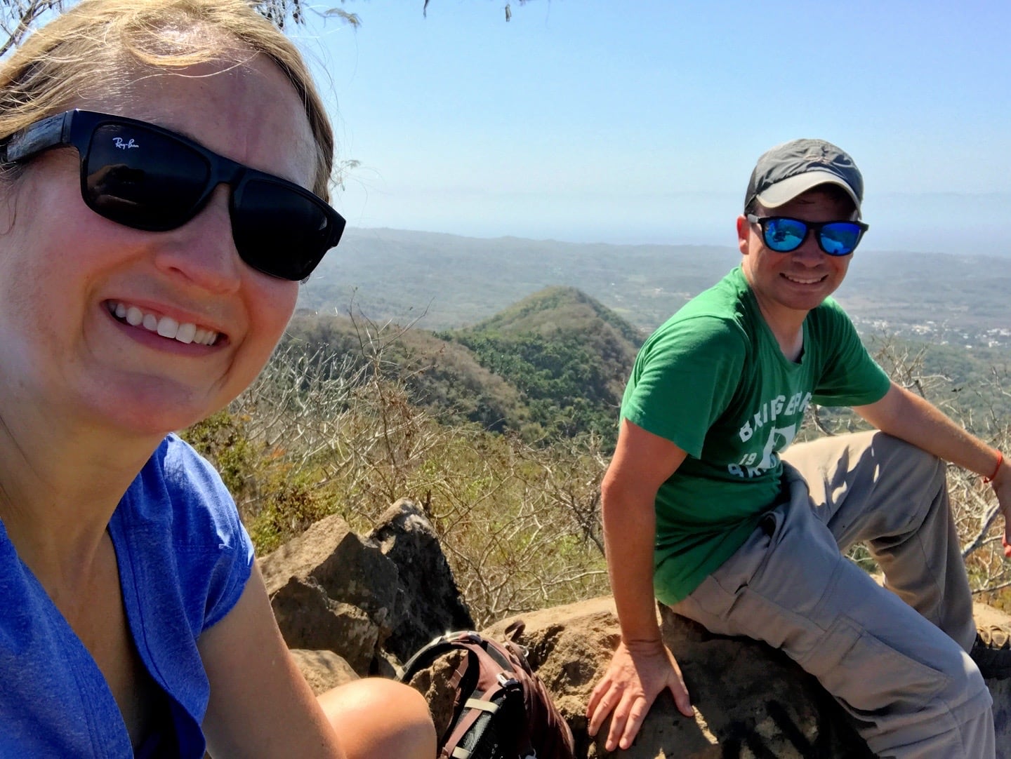
The top consists of a handful of large boulders, room enough for a small group of people.
We get the summit all to ourselves for about twenty minutes before a group of hikers arrives, at which point we decide it’s probably about time to start heading back.
Detour: Litibu Beach
We had a little bit of time before we needed to be back in Sayulita, so we made the cut over to Litibu Beach.
If you’re interested in visiting Litibu on your way back from Monkey Mountain, you can save yourself some time by taking one of the cut-over roads on your way back (see map).
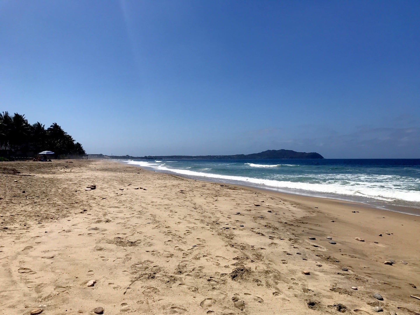
Litibu is a nice enough beach, fringed by palm trees and vacation homes. If you plan to spend any amount of time on Litibu, you’ll want to bring your own provisions, as services are very limited.
Litibu Grill, located on the beach at the end of the main road from Higuera Blanca, is perhaps your only option for a bite to eat. With that said, it is an excellent option (and priced accordingly).
Hiking from Sayulita
While we’d normally be up for a hardcore hiking adventure through the jungle, there were too many unknowns for us with the northern Sayulita-Cerro del Mono route.
Plus, we knew we had to be back to Sayulita by 1:30pm, so an 8-10 mile round trip hike was not in the cards this morning.
Most hikers who opt for the route from Sayulita don’t actually start in town, but drive half-way to the KM 5 turn off of the Punta de Mita Highway, starting their hike directly opposite of Hacienda Jaqueline guesthouse.
In our minds, if we were going to arrange a taxi to Hacienda Jaqueline we’d might as well just head down to Higuera Blanca. If you have your own transport (or are going with a guide), your options of course will be different.
The route from KM 5 to Cerro del Mono tends to get less foot traffic, isn’t as well maintained, and is generally harder to follow than the route from Higuera Blanca.
The terrain is steeper and more treacherous in places, and it’s a lot more remote. With that said, we’ve heard from a number of hikers who really liked their experience, particularly those who went with a guide.
If you do choose to hike this route on your own, make sure your well prepared with a sufficient supply of water and snacks, a map, and first-aid supplies.
Factor in plenty of time for getting lost and altering your return plans. Make sure you’ve pre-arranged your return transport or prepare for a very long hike back to Sayulita.
What to Pack for Your Hike
If you’re planning on hiking Cerro del Mono from Higuera Blanca outside of the rainy season, there isn’t a lot you’ll need to pack for this short hike.
Being in the tropics, your two main priorities will be staying hydrated and protecting yourself from the sun, particularly between 10am and 4pm.
With that in mind, 30+ SPF sunscreen and some sort of head protection (like a sun hat) are recommended.
While you’re slathering yourself up with sunscreen, we recommend putting on some insect repellant as well to help ward off ticks and mosquitos.
In terms of staying hydrated, we pack a reusable water bottle or lightweight hydration backpack.
Remember, you won’t want to drink the tap water in Sayulita, so try to fill your water bottle from a drinking water dispenser at your hotel or guesthouse to cut down on plastic waste. Many of the abarrotes/ minisupers (small grocery stores) in town sell 5L water jugs to refill from as well.
Sayulita and Punta de Mita get more than their fair share of sunny days, but do get a good amount of rain as well (mostly from June through October). During the wet summer months, it may help to pack a lightweight, breathable rain jacket.
While it is theoretically feasible to do this hike in flip-flops, we highly discourage it. The base of the boulder scramble at the top is littered with orphaned sandals, and it doesn’t take a lot of imagination to figure out why. Pack a sturdy pair of hiking shoes or hiking sandals (sandals often are better in the rainy season).
One or two telescopic trekking poles may also come in handy, particularly if conditions are very dry or muddy (there are some steep patches where it can get slick, especially on the way down). You’ll want telescopic because you will likely want your hands free to do the boulder scramble at the top (though you could probably just leave them near the base at the scramble and they’re not going to walk off).
Packing a compact first-aid kit is generally a good idea, particularly if you plan to hike alone or take the route from Sayulita/ KM 5.
If you plan on catching sunset on the summit, pack a headlamp for the return hike.
You may want to bring along a good camera to capture the stunning 360-degree views at the top. If you have a compact set of binoculars, it may be worth bringing those along as well.
Finally, be sure to bring along flexibility and a sense of adventure! In tropical climates (and oftentimes in Mexico) things don’t always go according to plan. Expect the unexpected and have fun!
More Reading for Your Mexico Trip
Nayarit & Jalisco
- Sayulita Beaches: Complete Guide to the Area’s Best
- Sayulita Hotels: A Resident’s Guide to the Best Stays
- Yelapa, Mexico: Why Visit & What to Expect
- Mascota, Jalisco: Detailed Guide for Planning Your Visit
- Playa Cuastecomates: Day Trip from Melaque (Jalisco)
The Yucatan & Caribbean
Baja Peninsula