Here’s something we don’t see everyday—an entire town literally wiped off the map by lava flows from an erupting volcano (Volcan Pericutin), where only the outer walls of the town’s sizeable church remain.
Located an hour west of the city of Uruapan, the Lava Church of Old San Juan Parangaricutiro has been on our radar for probably a decade. And today, we’re excited to finally make the trek out there to see it for ourselves.
Here’s our experience, plus first-hand tips for putting your own visit together.
Planning Your Own Volcano Adventure?
These are the tours we’d pick if we were planning our visit today from the UNESCO city of Morelia:
✪ Small Group Full-day Paricutin & Lava Church horseback tour + Cupatitzio National Park
✪ Private Tour Full-day tour to Paricutin Volcano & Lava Church
This post contains affiliate links. If you click and make a purchase, we might receive a commission (at no added cost to you). Thanks for supporting independent, ad-free blogs!
What Happened Here
First, a quick bit of background before we dive in. The devastation and aftermath that we’re about to encounter is a direct result of a volcanic eruption from the Paricutin Volcano, just four miles to the south of where we are now.
The craziest thing is that the volcano didn’t even exist before 1943. It sprang out of nowhere from a cornfield that year and continued to spew forth lava for nine years, ultimately covering an area of 90 square miles and slowly devouring the town of Old San Juan Parangaricutiro.
Hot Tip You can actually hike to the top of Volcan Paricutin (see our recommended tours, above!), but today, we’re content with exploring the Lava Church site with our two young boys.
Getting to Old San Juan Parangaricutiro
The Lava Church can be a bit tricky to get to if you’re coming in on your own.
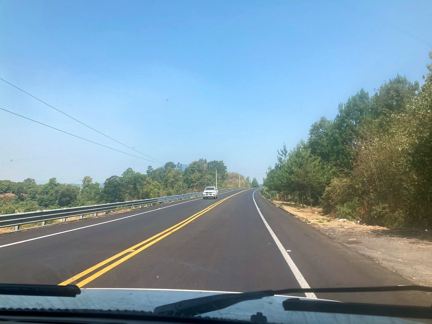
If you simply route to it on a map app, it’ll send you either through the forest on a rough road (which you definitely don’t want to do)—or—down the main highway, then on an unsealed road ending at the parking lot of the lava church.
If it’s dry season and you’ve got a high-clearance vehicle, you can probably get away with the second option. It takes a bit of time, but is relatively straight forward.
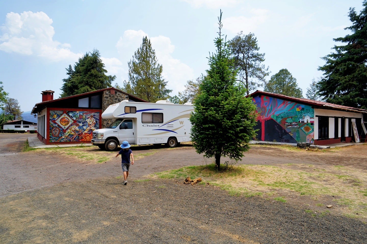
There is a third option, however, which is how we chose to reach the Lava Church in our 25-foot Class C RV. And that is to head to the village of Angahuan and make your way to the Centro Turístico de Angahuan (see map).
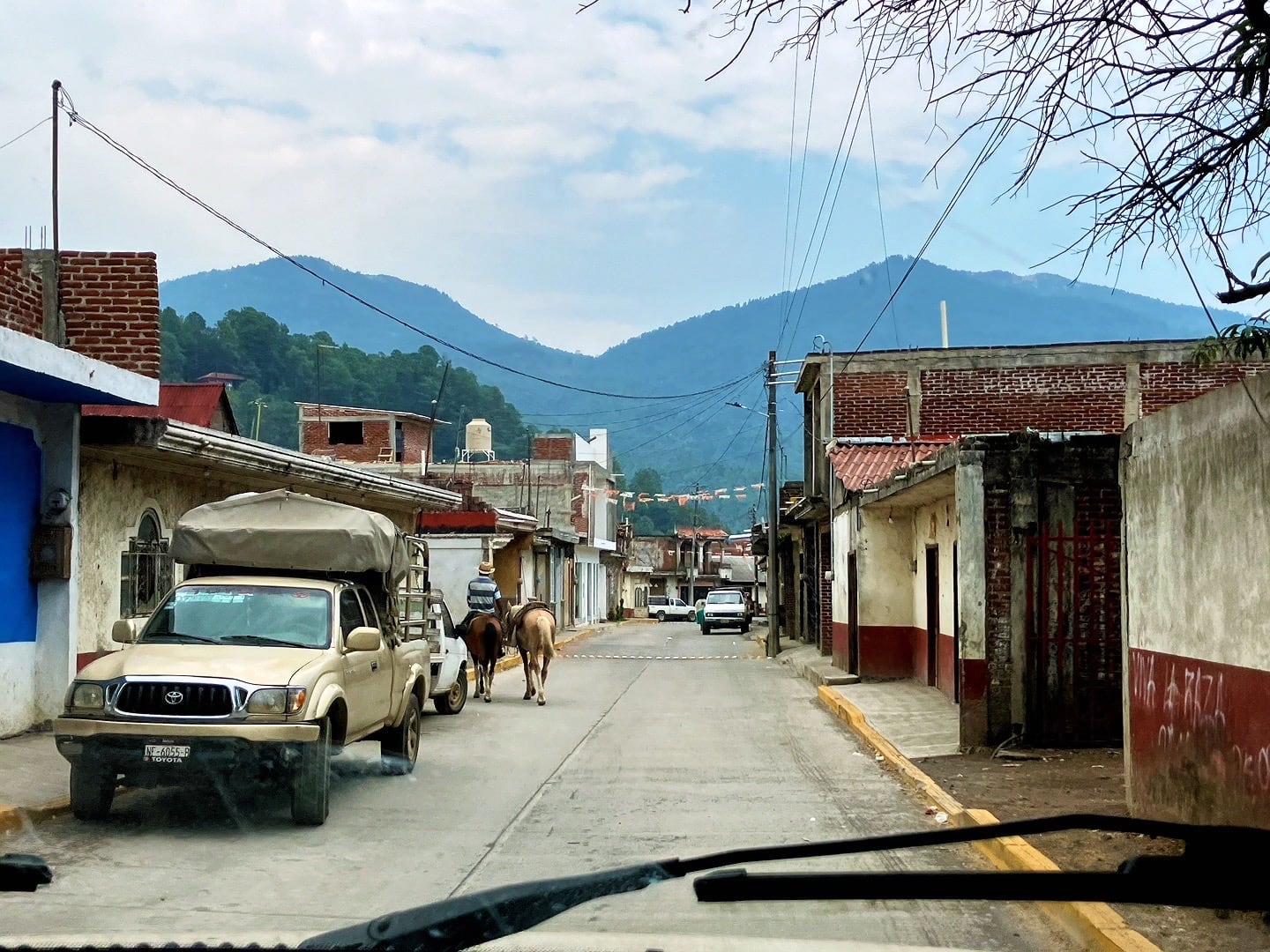
The narrow streets of Angahuan were a bit of a challenge in an RV, but not a concern in a regular-sized vehicle. The town is clean and tidy, for the most part, offering the basics if you need to stock up on water or snacks beforehand.
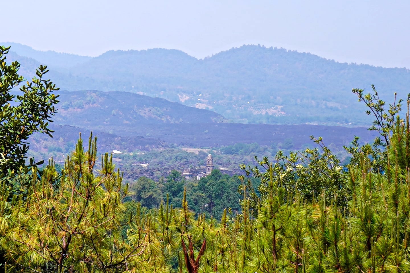
The tourist center is on the south end of town and offers secure parking for a fee and a mirador where you can view the church from a distance.
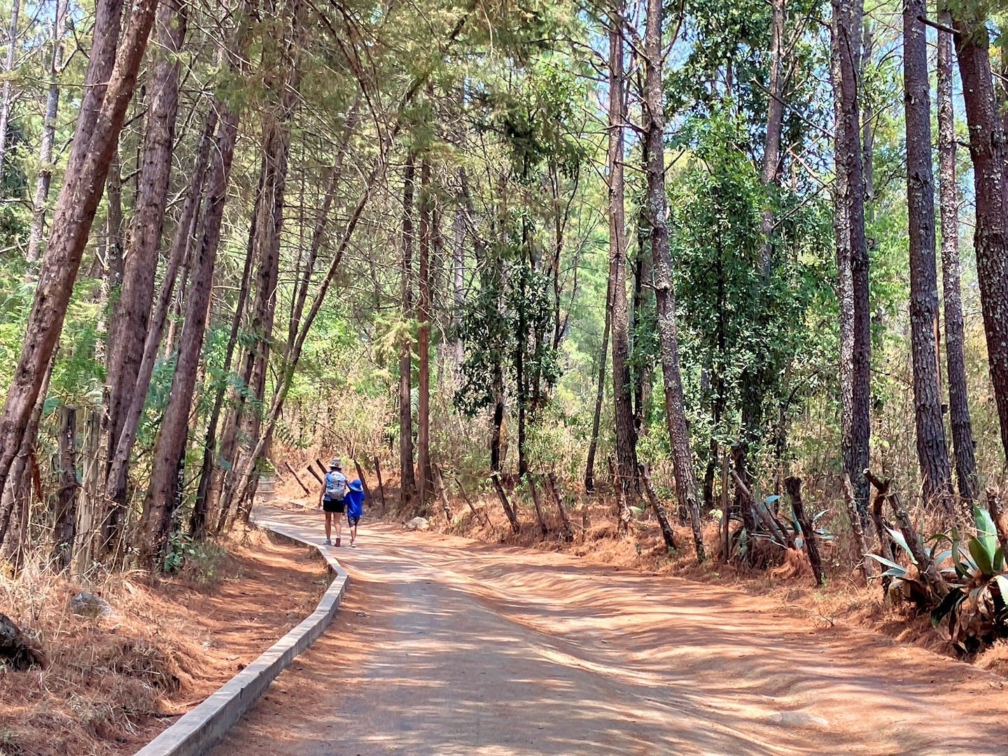
From here, it’s a 30-minute downhill hike on a well-maintained horse trail through the forest to reach the Lava Church site.
We start our hike at an elevation of 7,800 feet and hike about two miles to the church, which is at 7,500 feet elevation. Of course, when we’re done, we’ll have to turn around and hike back up the hill to the parking lot.
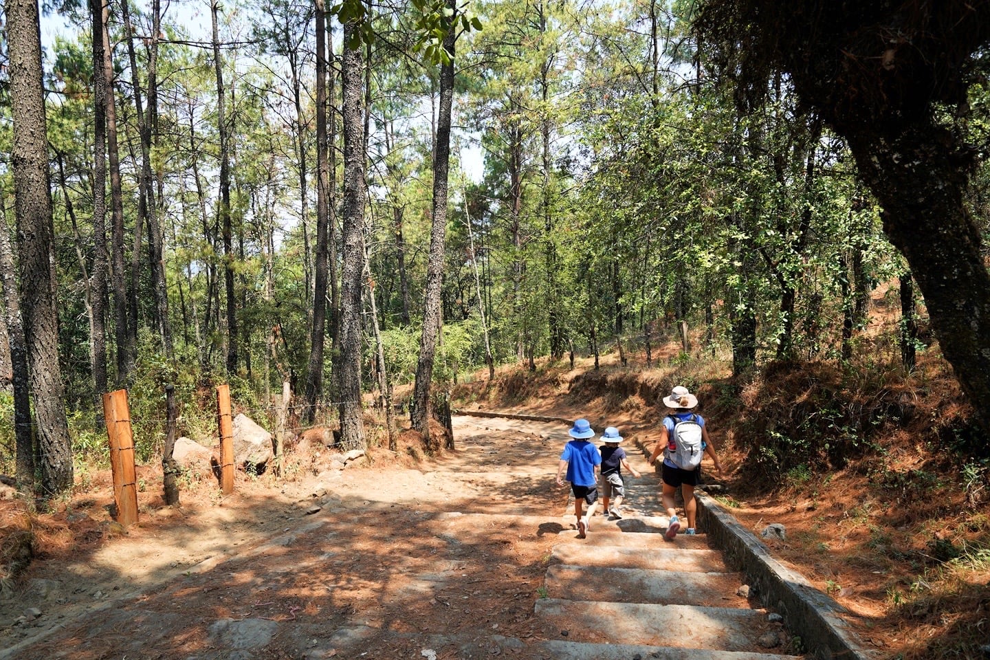
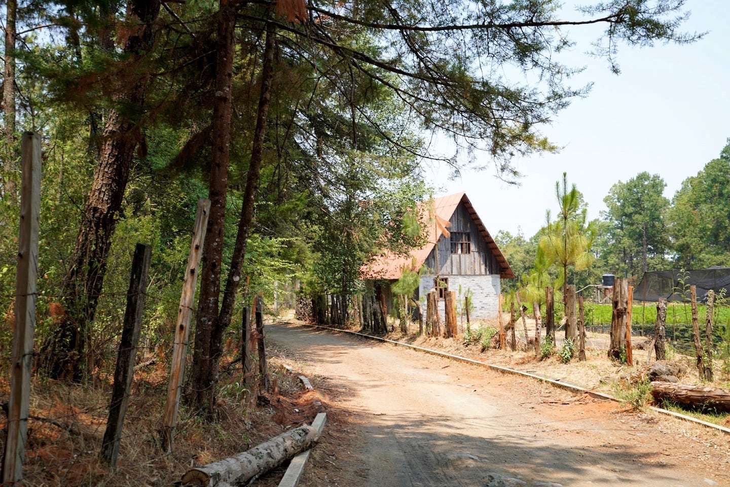
Along the way, we pass small family farms and ranches.
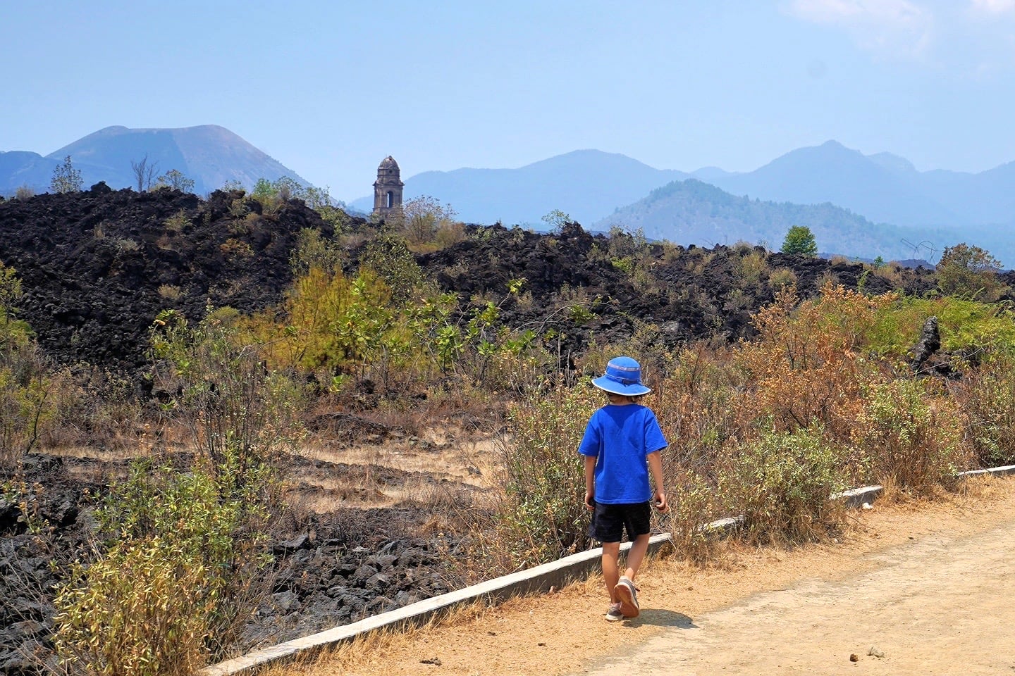
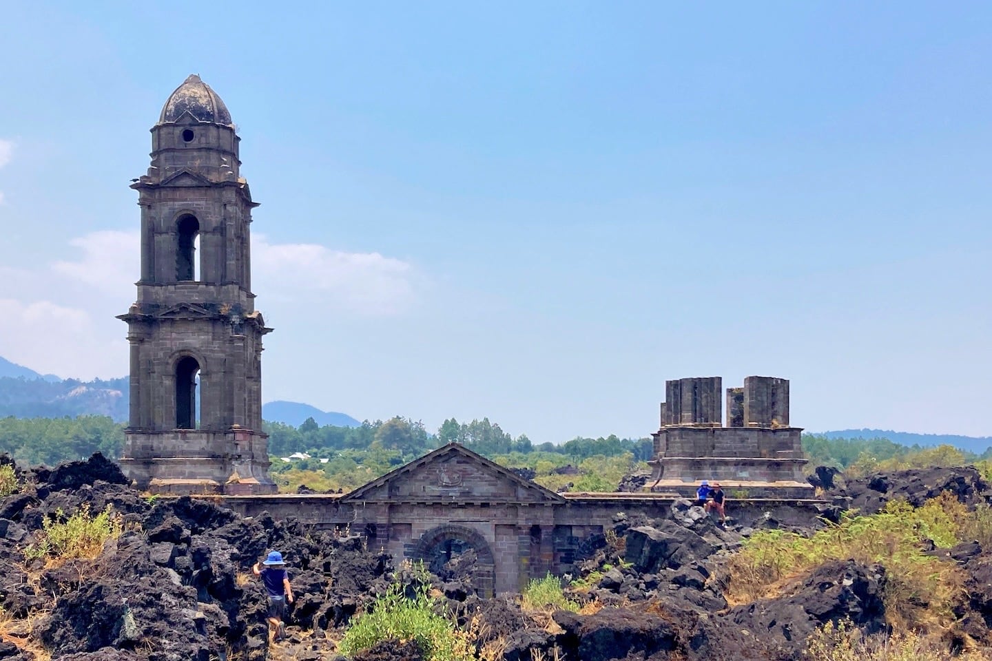
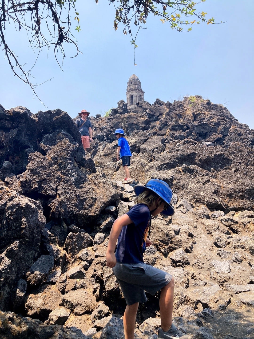
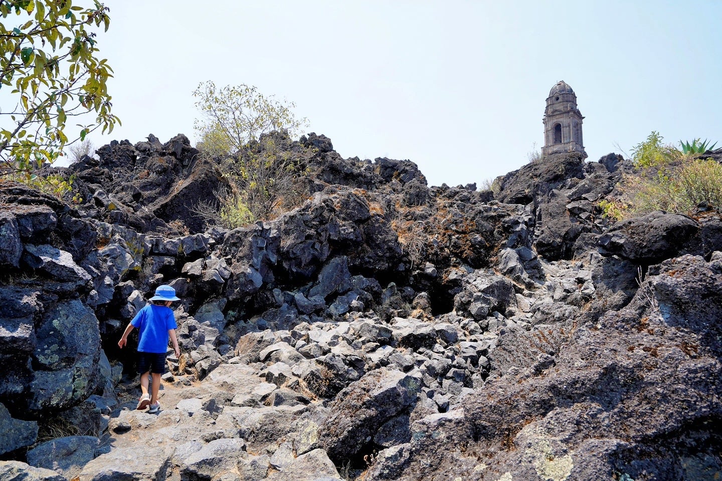
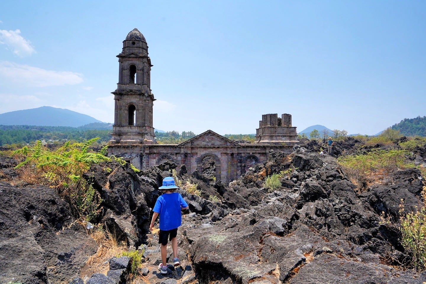
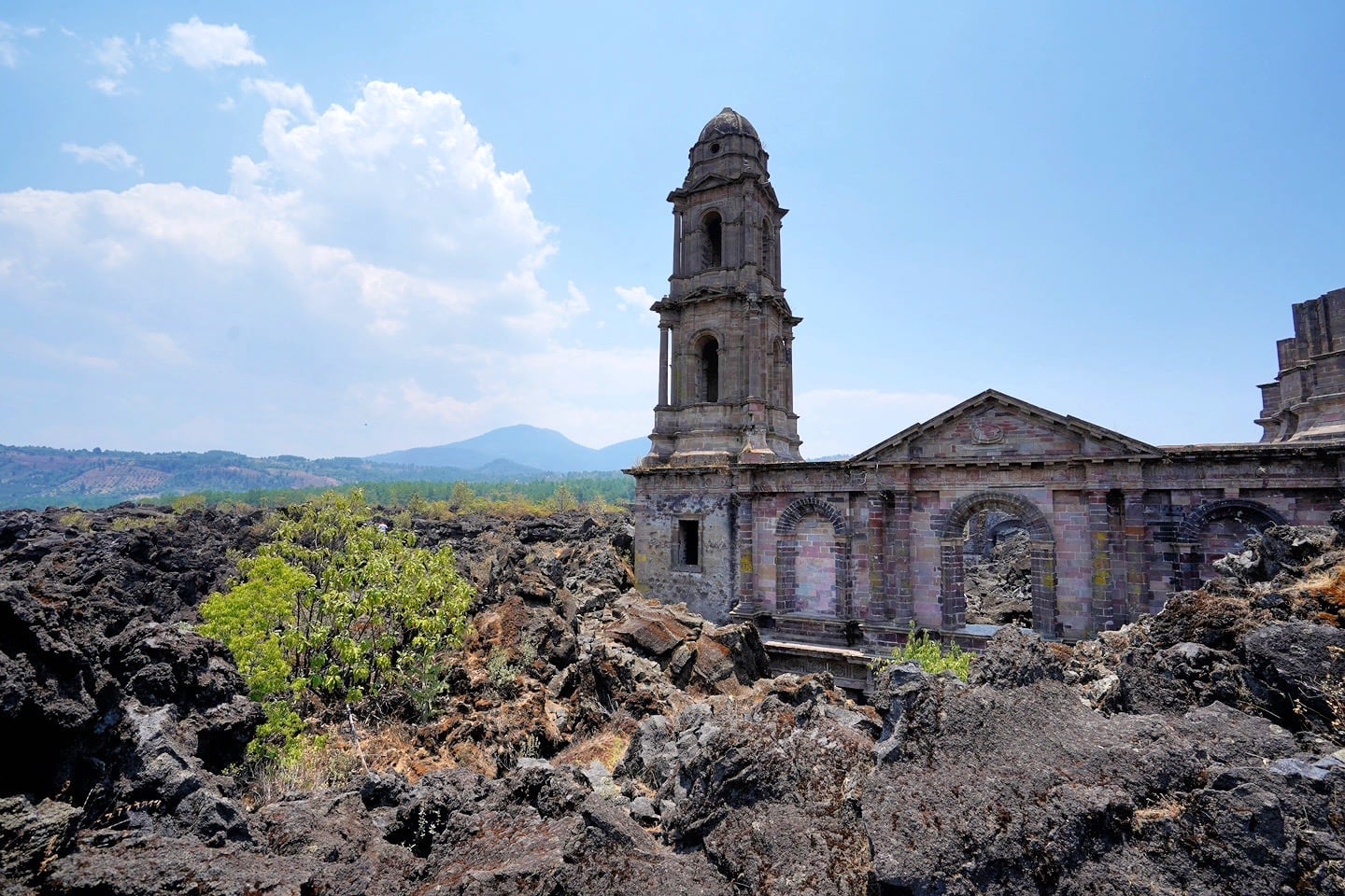
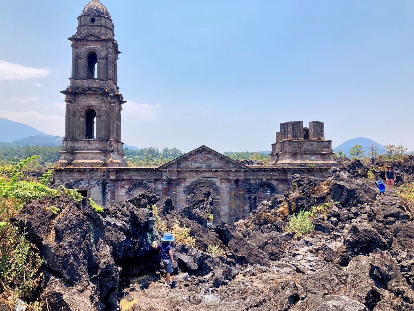
30 minutes after leaving the Tourist Center, we get our first up-close view of the ruins of Santuario del Señor de los Milagros (aka, the Lava Church), obscured by mountains of the black lava rock that blanketed the village of Old San Juan Parangaricutiro, courtesy of Paricutin Volcano.
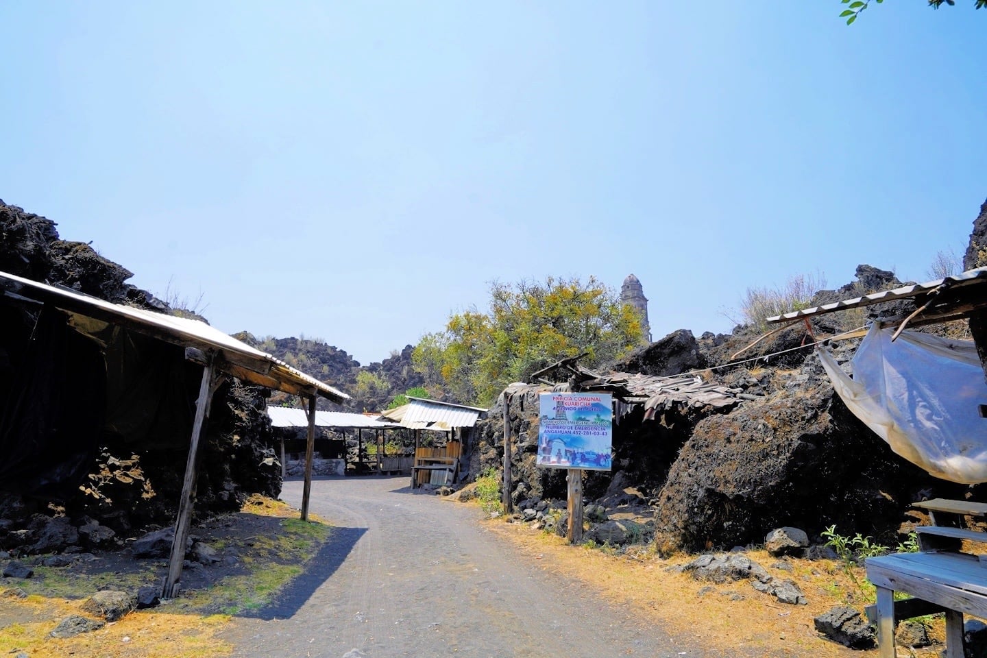
There’s a small settlement tucked into the nooks and crannies of the lava fields where you can grab Gorditas, water and beer, or a local guide.
It’s impossible for us to believe that there used to be an entire town here—now buried beneath the rock for some 80 years.
Exploring the Ruins of Santuario del Señor de los Milagros
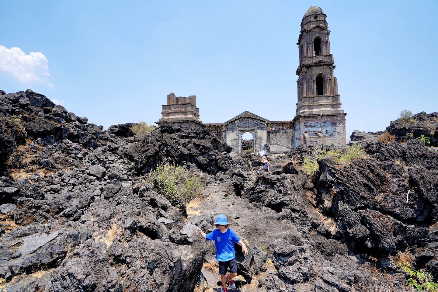
The route up to the church isn’t easy, but it isn’t the hardest trail we’ve tackled either.
The lava rock is stable and grippy, if uneven, and the climb up to the ruins is shorter than we thought. Our youngest needed some encouragement in spots, but our seven-year-old bounded up with ease.
Just watch the heat! The site is completely exposed and it can get very warm up here, particularly in the spring and summer time just before the rains. We recommend taking good measures to protect yourself from the sun and pack ample water.
Also, if you’re not acclimated to the elevation, you’ll want to take your time exploring the area. No need to hurry on this one.
If you’re exploring on your own, use the map below on your device to follow along. We recommend the Gaia app for this sort of thing, which uses crowd-sourced OpenStreetMap.org maps.
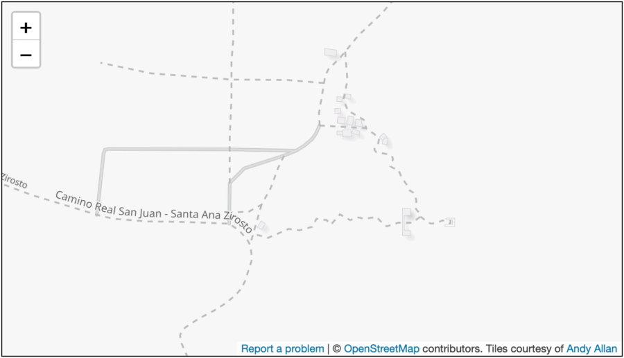
In the map, above, the ruins of the church are just southeast east of the center of the image. If you don’t mind a bit of scrambling over lava boulders, you can make a little loop.
However, we opted to do the walk in two separate chunks: First from the main parking lot/ snack shacks, then from the covered viewing area/ shrine (where the word “Zirosto” appears on the map, above).
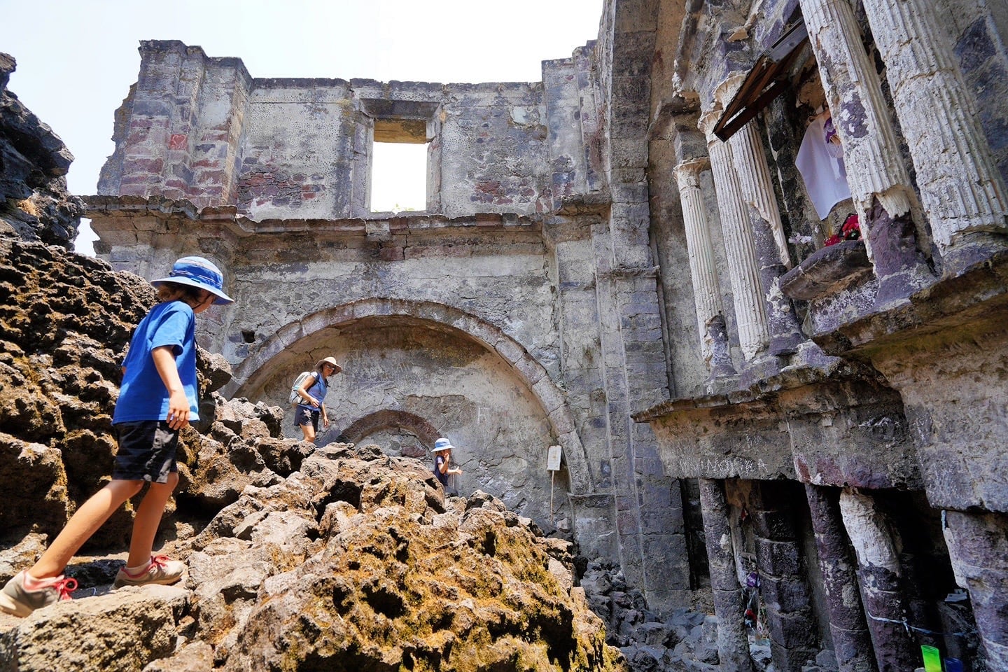
The trail in and around the front of the nave is arguably the most difficult part to manage if you are doing a loop.
The Northern Route
Starting from the cluster of snack shacks, we made our way up the lava flows towards the north side of the church.
This seems to be the most popular route for accessing the church, as we encountered a dozen or so other visitors doing the same, but only one or two later on the western route.
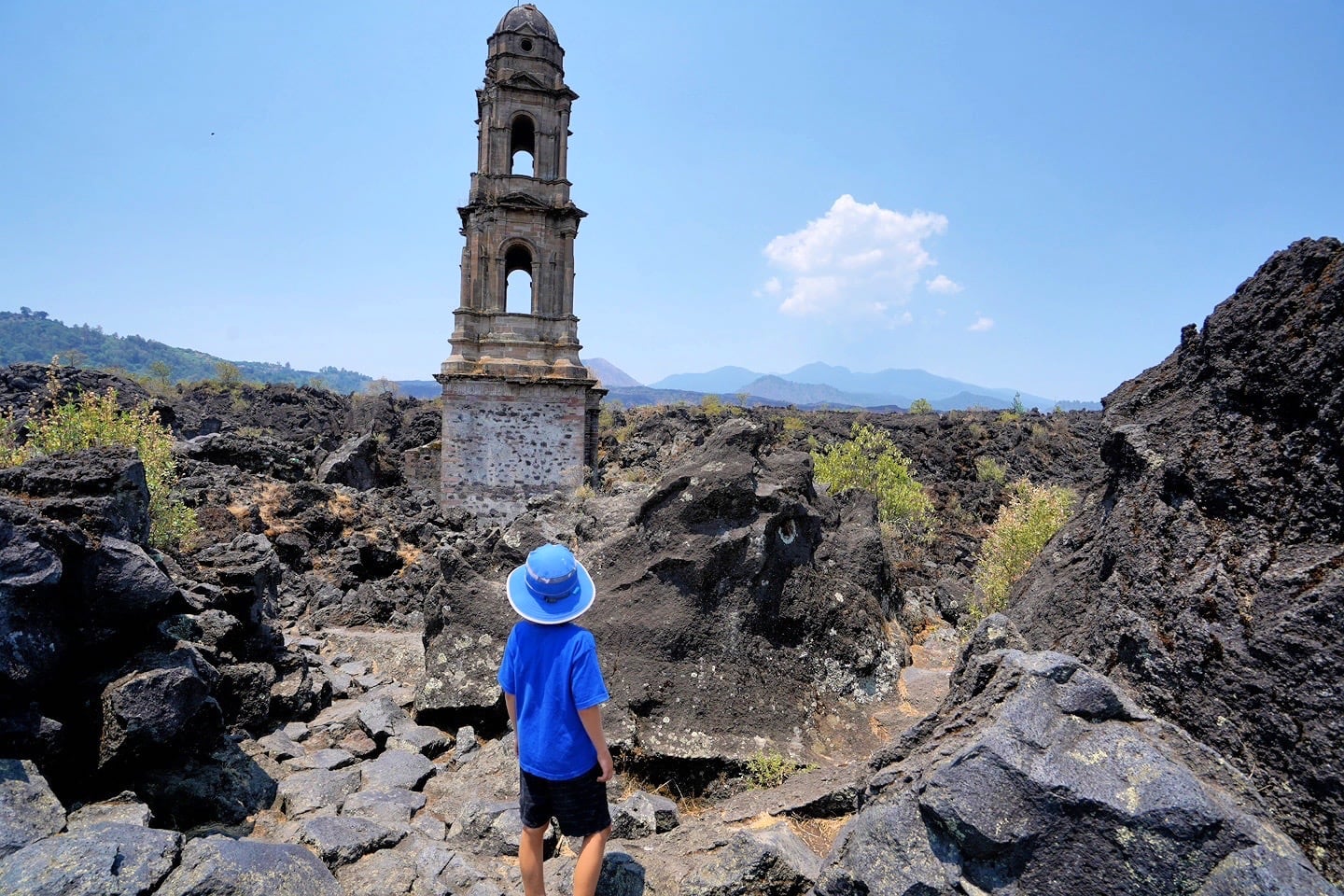
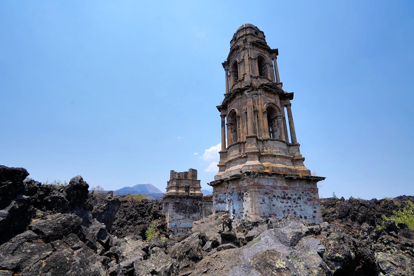
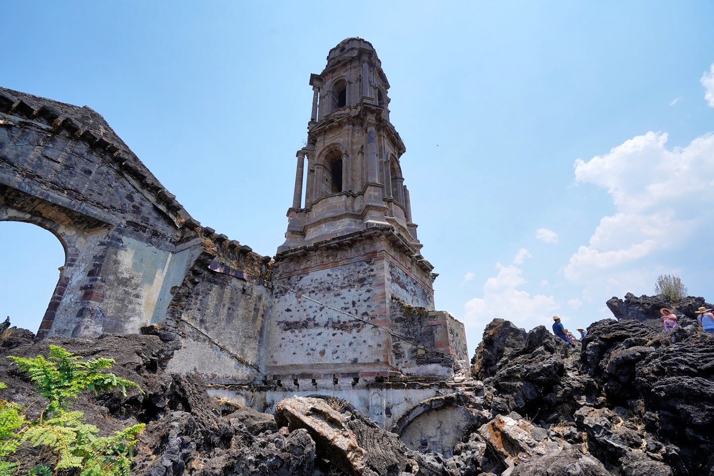
During our visit, we wondered why one bell town remained standing while the other appeared to collapse.
Later, we learned that the second bell tower didn’t collapse from the volcano, but that they were working on constructing that tower when the volcano started to devour San Juan Parangaricutiro. For this reason, it was never completed.
You can actually see what the church and some of Old San Juan Parangaricutiro looked like before the lava flow reached the church in this vintage postcard image.
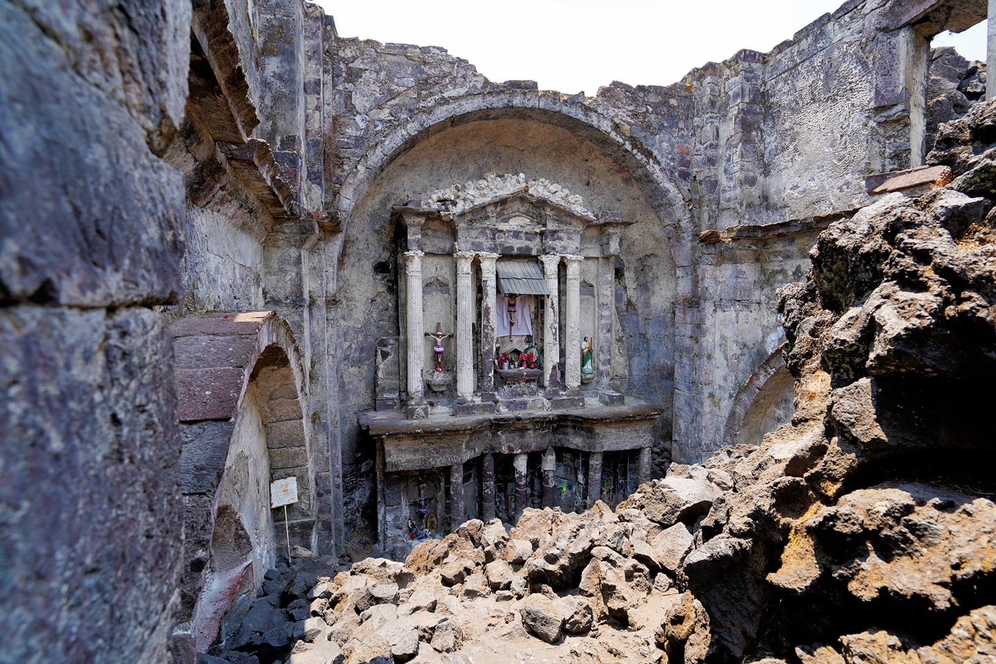
I took the above photo standing at the altar looking back at the front of the nave, which might give you an idea of the scale of this place. Not a small little chapel.
In fact, much of the original altar survived the devastation. Local residents attribute this to a miracle and pilgrims from across the region visit to pray and leave offerings.
The Western Route
We returned to the parking lot and made our way southwest along the main access road to an elevated covered pavilion where we found a second trail leading to the front of the ruined church.
This route takes a bit longer, but offers better views of San Juan Parangaricutiro and the lava church (and thus better photo opportunities).
By the time we retraced our steps on this second route, we were starting to feel the altitude.
Walking all day yesterday at 5,500 feet in Uruapan didn’t seem to have nearly the same effect as hiking to and around the lava fields at 7,500 feet.
Granted, it’s not the easiest thing spending a couple of hours steadying yourself on lava rock. Still, we were a bit surprised and weren’t exactly looking forward to the two-mile [uphill] return journey.
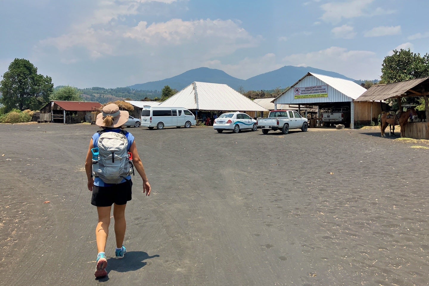
This is the parking area at the Lava Church complex, which might give you some idea of what the road surface is like the last few miles in (fine ash and dust), if you choose to drive the entire way.
In the end, the wooded walk back up the hill was perfectly manageable at a slow pace. But we were still quite happy to arrive back at the RV and not have to walk anymore today.
We really enjoyed our time in Old San Juan Parangaricutiro, and would recommend it to anyone traveling to the region in search of something they won’t find elsewhere in Mexico.
More Reading for Your Mexico Trip
Michoacan
- Isla de Janitzio (Patzcuaro): What to See & How to Visit
- Tzintzuntzan Pyramids & Pueblo Magico (Patzcuaro)
More Central Highlands
- 6 Best Ways to Tour Teotihuacan from Mexico City
- Xochimilco Floating Gardens (CDMX): Visitor Guide
- Sanctuary of Atotonilco (San Miguel de Allende)
- Monte Albán (Oaxaca): Complete Guide to Visiting
Mexico Beach Towns
- Sayulita Beaches (Nayarit): Insider’s Guide to the Best
- Playa Cuastecomates (Jalisco): Melaque Day Trip
- Yelapa (Jalisco): Why Visit & What to Expect
- Puerto Morelos (Quintana Roo): Why Visit
- Arch of Cabo San Lucas (Baja Sur): 5 Fun Ways to Visit
- La Paz Beaches (Baja Sur): Insider’s Guide to the Best
- Cabo Pulmo (Baja Sur): Visiting the World’s Aquarium